Police Helicopter to Brandy Carr, Stoney Lane
Thursday, 21 May 2026 | 15:38 | From Wrenthorpe
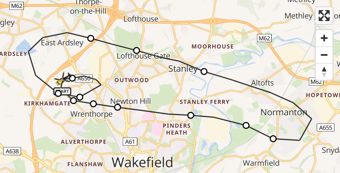
On Thursday, 21 May 2026 at 15:38, a Police Helicopter departed from Wrenthorpe to Brandy Carr. It was the Police Helicopter with registration number G-POLB. The flight lasted 8 minutes. During that period, the aircraft travelled 16 miles at an average speed of 121 miles per hour at a maximum altitude of 1500 feet.
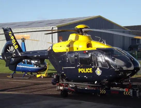
Helicopter: G-POLB
The helicopter G-POLB is used by the British police. The helicopter is deployed in pursuits, missing persons cases and other incidents where a helicopter provides added value.
Photo: James from Cheltenham, Gloucestershire
17 miles
1500 feet
121 mph
8 minutes
15:38
15:46

Route
Stoney Lane, West Yorkshire - Wakefield15:46
East Ardsley, Wakefield15:46
Wrenthorpe, Wakefield15:45
Brandy Carr, Wakefield15:45
East Ardsley, Leeds15:43
Lofthouse Gate, Wakefield15:43
Stanley, Wakefield15:42
Normanton and Altofts, Wakefield15:40
Newland with Woodhouse Moor, Wakefield15:40
Stanley, Wakefield15:40
Newton Hill, Wakefield15:39
Wrenthorpe, Wakefield15:39
Brandy Carr, Wakefield15:38
Brandy Carr Road, West Yorkshire - Wakefield15:38
Live flights
Flights Wrenthorpe
Police Helicopter to Brandy Carr, M13 Jul 07:27
Police Helicopter to East Ardsley, M125 Jun 20:53
Police Helicopter to East Ardsley, M125 Jun 19:32
Police Helicopter to East Ardsley, M125 Jun 14:16
Police Helicopter to East Ardsley, M123 Jun 21:24
Police Helicopter to Stainforth, Stainforth Road23 Jun 15:28
Police Helicopter to East Ardsley, Stoney Lane23 Jun 11:30
Helicopter flights on your website?
You can easily display helicopter flights on your own website. Use the embed code.
