Air Ambulance Helicopter to Rockbeare, Westcott Road
Wednesday, 8 April 2026 | 13:57 | From Branscombe
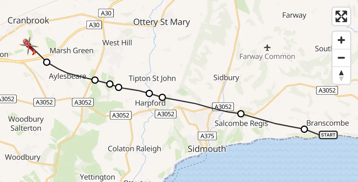
On Wednesday, 8 April 2026 at 13:57, a Air Ambulance Helicopter departed from Branscombe to Rockbeare. It was the Air Ambulance Helicopter with registration number G-DAAN. The flight lasted 6 minutes. During that period, the aircraft travelled 12 miles at an average speed of 124 miles per hour at a maximum altitude of 1075 feet.
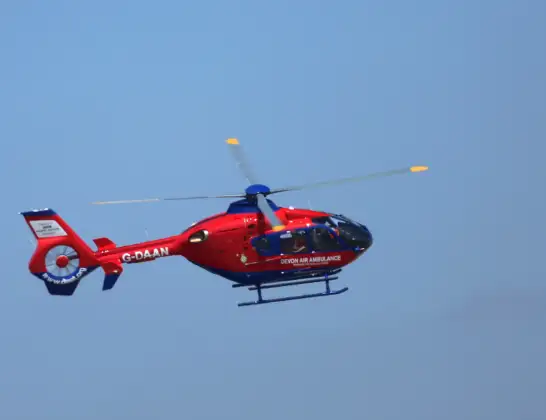
Helicopter: G-DAAN
The helicopter G-DAAN is used as a air ambulance helicopter. The main purpose of this aircraft is to transport a Mobile Medical Team to an incident as quickly as possible, enabling the trauma doctor to provide immediate first aid on site. The aircraft is flying this flight as Air Ambulance Helicopter.
Photo: Ronnie Macdonald
13 miles
1075 feet
124 mph
7 minutes
13:57
14:03

Route
Westcott Road, Devon14:03
Rockbeare, Devon14:02
Aylesbeare, Devon14:01
East Devon, Devon14:01
Newton Poppleford, Devon14:01
Tipton St John, Devon14:00
East Devon, Devon14:00
Sidmouth, Devon13:58
East Devon, Devon13:57
FP 3, Devon13:57
Live flights
Today
Coastguard Helicopter to Cumnock21:36:40
Police Helicopter to Gellifor21:24:37
Flights Rockbeare
Police Helicopter to Rockbeare, Silver Lane5 Jul 20:57
Police Helicopter to Rockbeare, Gribble Lane5 Jul 16:32
Police Helicopter to Rockbeare, Silver Lane4 Jul 18:20
Police Helicopter to Rockbeare, Westcott Road30 Jun 18:50
Police Helicopter to Rockbeare, Westcott Road29 Jun 16:58
Police Helicopter to Rockbeare, Westcott Road28 Jun 18:29
Police Helicopter to Rockbeare, Yarlington Mill27 Jun 21:56
Flights Branscombe
Helicopter flights on your website?
You can easily display helicopter flights on your own website. Use the embed code.
