Air Ambulance Helicopter to City of Westminster, West Carriage Drive
Tuesday, 7 April 2026 | 19:17 | From Kilburn
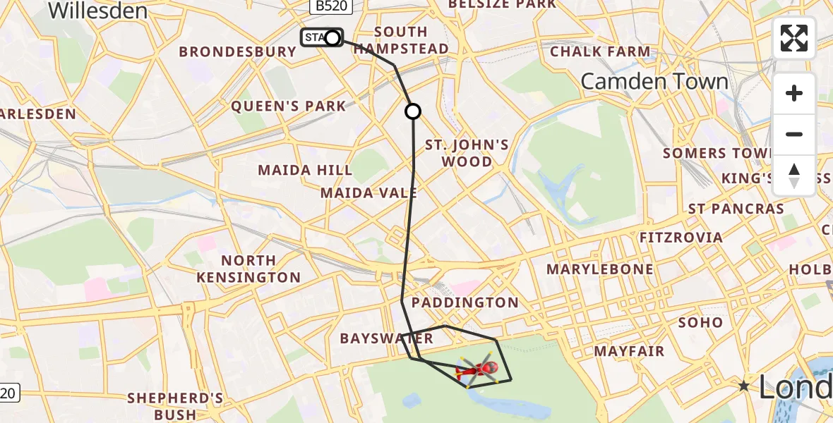
On Tuesday, 7 April 2026 at 19:17, a Air Ambulance Helicopter departed from Kilburn to City of Westminster. It was the Air Ambulance Helicopter with registration number G-LAAA. The flight lasted 5 minutes. During that period, the aircraft travelled 5 miles at an average speed of 63 miles per hour at a maximum altitude of 600 feet.
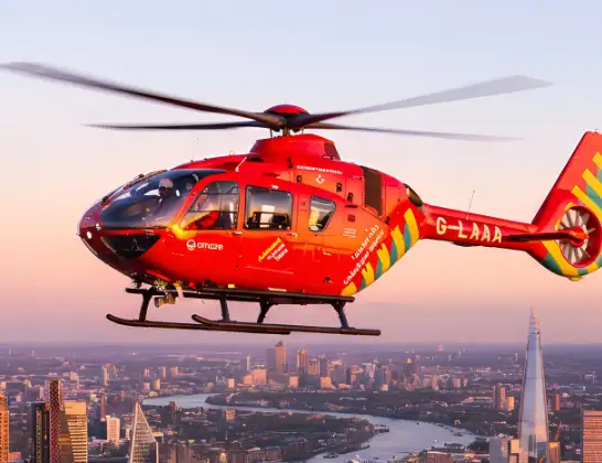
Helicopter: G-LAAA
The helicopter G-LAAA is used as a air ambulance helicopter. The main purpose of this aircraft is to transport a Mobile Medical Team to an incident as quickly as possible, enabling the trauma doctor to provide immediate first aid on site. The aircraft is flying this flight as Air Ambulance Helicopter.
Photo: Ton Snoei
6 miles
600 feet
63 mph
5 minutes
19:17
19:22

Route
West Carriage Drive, Greater London - Westminster19:22
City of Westminster, Westminster19:18
South Hampstead, Camden19:17
Espalier Gardens, Greater London - Camden19:17
Live flights
Today
Police Helicopter to Hawarden Airport7 Apr 23:46
Air Ambulance Helicopter to Croespen-maen7 Apr 23:37
Air Ambulance Helicopter to Glasgow Airport7 Apr 23:15
Air Ambulance Helicopter to Norwich Airport7 Apr 22:57
Air Ambulance Helicopter to Inverness, Dores7 Apr 22:56
Police Helicopter to Wrenthorpe, M17 Apr 22:52
Flights Kilburn
Helicopter flights on your website?
You can easily display helicopter flights on your own website. Use the embed code.
