Air Ambulance Helicopter to Aberdaron, B4413
Tuesday, 7 April 2026 | 11:02 | From Caernarfon Airport
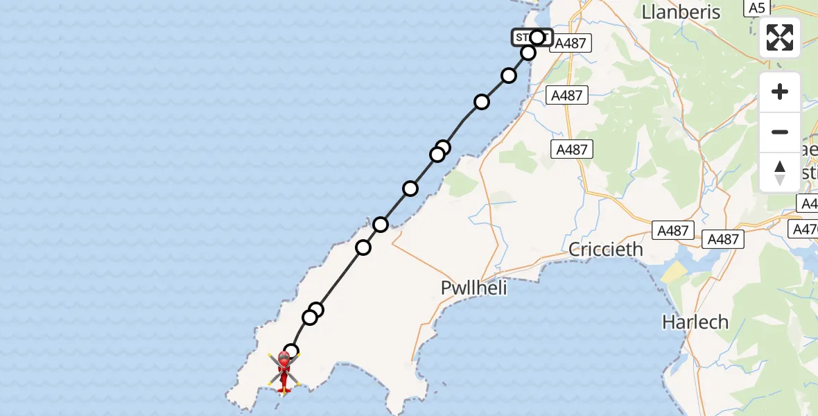
On Tuesday, 7 April 2026 at 11:02, a Air Ambulance Helicopter departed from Caernarfon Airport to Aberdaron. It was the Air Ambulance Helicopter with registration number G-WOBR. The flight lasted 15 minutes. During that period, the aircraft travelled 26 miles at an average speed of 104 miles per hour at a maximum altitude of 1000 feet.
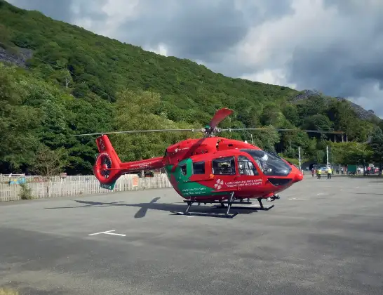
Helicopter: G-WOBR
The helicopter G-WOBR is used as a air ambulance helicopter. The main purpose of this aircraft is to transport a Mobile Medical Team to an incident as quickly as possible, enabling the trauma doctor to provide immediate first aid on site. The aircraft is flying this flight as Air Ambulance Helicopter.
Photo: Hefin Owen
27 miles
1000 feet
104 mph
16 minutes
11:02
11:17

Route
B4413, Gwynedd11:17
Aberdaron, Gwynedd11:15
Botwnnog, Gwynedd11:14
Sarn Mellteyrn, Gwynedd11:13
Tudweiliog, Gwynedd11:11
Morfa Nefyn, Gwynedd11:11
Nefyn, Gwynedd11:09
11:08
Trefor, Gwynedd11:08
Irish Sea11:06
11:05
Dinas Dinlle, Gwynedd11:04
Dinas Dinlle, Gwynedd11:04
Llanfaglan, Gwynedd11:03
Caernarfon Airport, Caernarfon11:02
Live flights
Today
Flights Aberdaron
Coastguard Helicopter to Caernarfon Airport7 May 00:21
Coastguard Helicopter to Aberdaron, Lôn Plas17 Apr 15:55
Coastguard Helicopter to Aberdaron, Lôn Plas17 Apr 15:44
Air Ambulance Helicopter to Aberdaron, B44137 Apr 11:02
Helicopter flights on your website?
You can easily display helicopter flights on your own website. Use the embed code.
