Coastguard Helicopter to Altarnun
Tuesday, 7 April 2026 | 9:58 | From Cornwall Airport Newquay
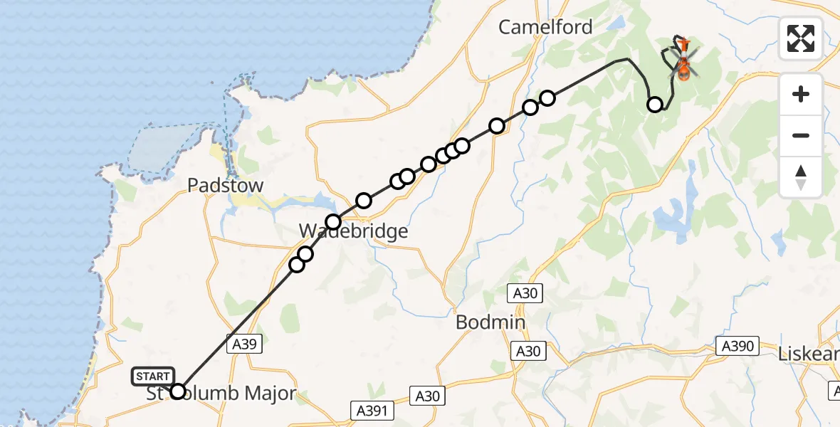
On Tuesday, 7 April 2026 at 9:58, a Coastguard Helicopter departed from Cornwall Airport Newquay to Altarnun. It was the Coastguard Helicopter with registration number G-MCGF. The flight lasted 23 minutes. During that period, the aircraft travelled 30 miles at an average speed of 80 miles per hour at a maximum altitude of 1600 feet.
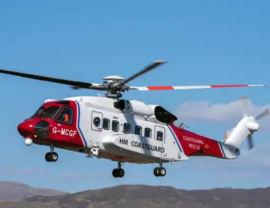
Helicopter: G-MCGF
The helicopter G-MCGF is used by the British Coastguard. The helicopter is deployed in search and rescue operations at sea, rescue operations involving ships or drilling platforms, patrols to prevent smuggling or piracy, environmental monitoring and disaster relief support.
Photo: The Carlisle Kid
31 miles
1600 feet
80 mph
23 minutes
09:58
10:21

Route
Altarnun, Cornwall10:21
Altarnun, Cornwall10:14
St. Breward, Cornwall10:10
Helstone, Cornwall10:10
Michaelstow, Cornwall10:09
St Tudy, Cornwall10:08
St Teath, Cornwall10:08
St Kew, Cornwall10:08
St Kew Highway, Cornwall10:07
Bodieve, Cornwall10:07
St Kew Highway, Cornwall10:07
Bodieve, Cornwall10:06
Wadebridge, Cornwall10:05
Whitecross, Cornwall10:04
St. Breock, Cornwall10:04
St. Columb Major, Cornwall10:01
Cornwall Airport Newquay, Newquay10:00
Cornwall Airport Newquay, Newquay09:58
Live flights
Today
Police Helicopter to Glasgow, South Street6 Jul 23:22
Police Helicopter to South Lanarkshire6 Jul 23:09
Police Helicopter to North Weald Airfield6 Jul 22:57
Police Aircraft to East Midlands Airport6 Jul 22:56
Police Helicopter to Lochhead, A726 Jul 22:39
Flights Altarnun
Coastguard Helicopter to Altarnun21 May 15:35
Coastguard Helicopter to Altarnun21 May 15:25
Coastguard Helicopter to Lansallos, Polperro7 Apr 10:27
Coastguard Helicopter to Altarnun7 Apr 10:21
Coastguard Helicopter to Altarnun7 Apr 09:58
Coastguard Helicopter to Altarnun, A3020 Mar 15:42
Coastguard Helicopter to Altarnun, A3020 Mar 14:34
Helicopter flights on your website?
You can easily display helicopter flights on your own website. Use the embed code.
