Police Helicopter to MOD St Athan
Monday, 6 April 2026 | 22:18 | From Cwmavon
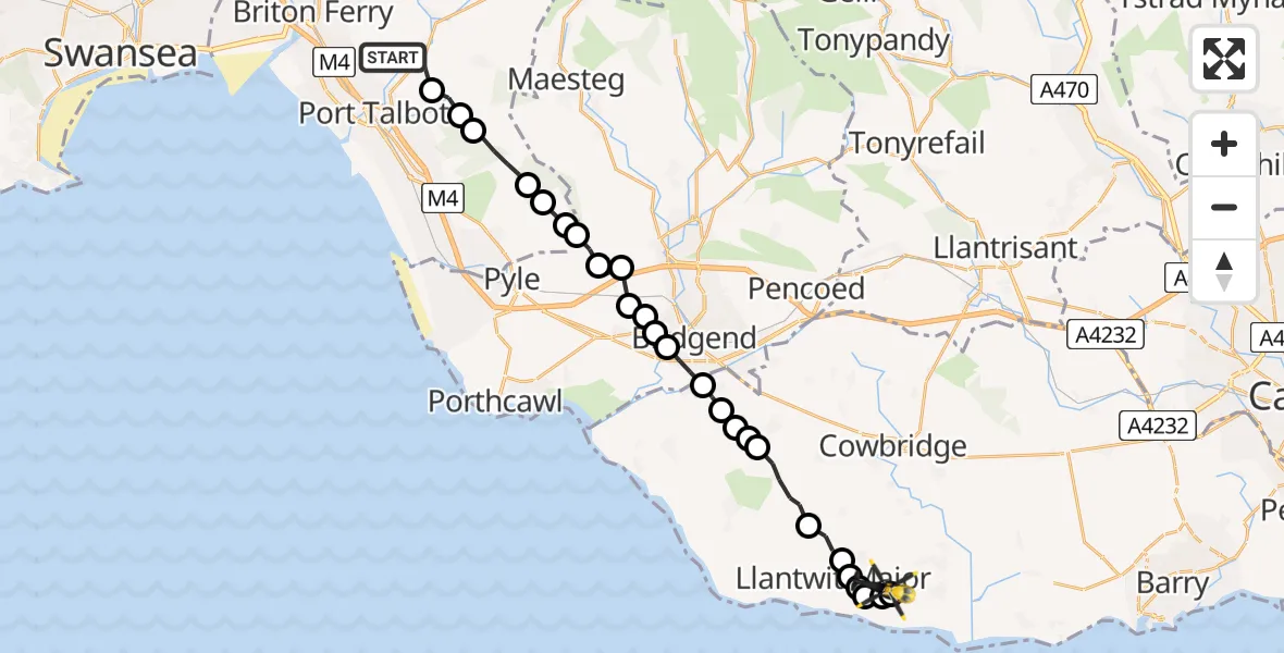
On Monday, 6 April 2026 at 22:18, a Police Helicopter departed from Cwmavon to MOD St Athan. It was the Police Helicopter with registration number G-NWOI. The flight lasted 12 minutes. During that period, the aircraft travelled 22 miles at an average speed of 112 miles per hour at a maximum altitude of 1900 feet.
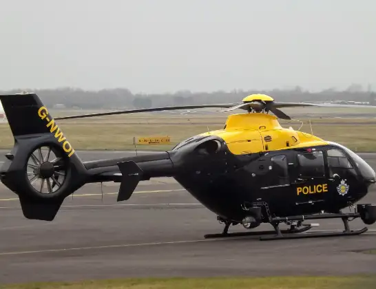
Helicopter: G-NWOI
The helicopter G-NWOI is used by the British police. The helicopter is deployed in pursuits, missing persons cases and other incidents where a helicopter provides added value.
Photo: James from Cheltenham
23 miles
1900 feet
112 mph
12 minutes
22:18
22:30

Route
MOD St Athan, St Athan, Vale of Glamorgan22:30
MOD St Athan, St Athan, Vale of Glamorgan22:30
Boverton, Vale of Glamorgan22:30
Llantwit Major, Vale of Glamorgan22:29
Boverton, Vale of Glamorgan22:29
Llantwit Major, Vale of Glamorgan22:28
Llanmaes, Vale of Glamorgan22:28
Llantwit Major, Vale of Glamorgan22:27
Llandow, Vale of Glamorgan22:26
Colwinston, Vale of Glamorgan22:26
Ewenny, Vale of Glamorgan22:26
Corntown, Vale of Glamorgan22:25
Ewenny, Vale of Glamorgan22:25
Bridgend, Bridgend22:24
Broadlands, Bridgend22:24
Cefn Glas, Bridgend22:24
Bryntirion, Bridgend22:23
Aberkenfig, Bridgend22:23
Cefn Cribwr, Bridgend22:23
Llangynwyd Lower, Bridgend22:22
Pen y Bryn, Neath Port Talbot22:22
Margam, Neath Port Talbot22:22
Pen y Bryn, Neath Port Talbot22:21
Margam, Neath Port Talbot22:20
Bryn, Neath Port Talbot22:20
Port Talbot, Neath Port Talbot22:19
Woodland Row, Neath Port Talbot22:18
Live flights
Police Helicopter on its way from Coopersale6 Jul 22:57
Today
Police Helicopter to Lochhead, A726 Jul 22:39
Air Ambulance Aircraft to Greenigoe6 Jul 21:45
Coastguard Helicopter to Humberside Airport6 Jul 21:43
Air Ambulance Helicopter to RAF Northolt6 Jul 21:24
Police Helicopter to Birmingham Airport6 Jul 21:17
Flights Cwmavon
Air Ambulance Helicopter to Dafen, Heol Aur11 May 19:17
Police Helicopter to MOD St Athan3 May 19:28
Police Helicopter to Cwmavon, Heol-y-Graig22 Apr 20:06
Police Helicopter to Cwmavon, Afan Valley Road21 Apr 20:04
Police Helicopter to MOD St Athan6 Apr 22:18
Helicopter flights on your website?
You can easily display helicopter flights on your own website. Use the embed code.
