Air Ambulance Helicopter to Malvern, Merton Road
Sunday, 5 April 2026 | 16:39 | From Malvern
On Sunday, 5 April 2026 at 16:39, a Air Ambulance Helicopter departed from Malvern to Malvern. It was the Air Ambulance Helicopter with registration number G-OMAA. The flight lasted 33 minutes. During that period, the aircraft travelled 4 miles at an average speed of 7 miles per hour at a maximum altitude of 1200 feet.
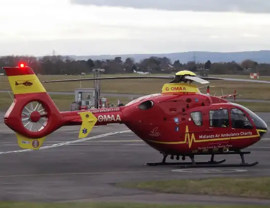
Helicopter: G-OMAA
The helicopter G-OMAA is used as a air ambulance helicopter. The main purpose of this aircraft is to transport a Mobile Medical Team to an incident as quickly as possible, enabling the trauma doctor to provide immediate first aid on site. The aircraft is flying this flight as Air Ambulance Helicopter.
Photo: James from Cheltenham, Gloucestershire
4 miles
1200 feet
7 mph
33 minutes
16:39
17:12

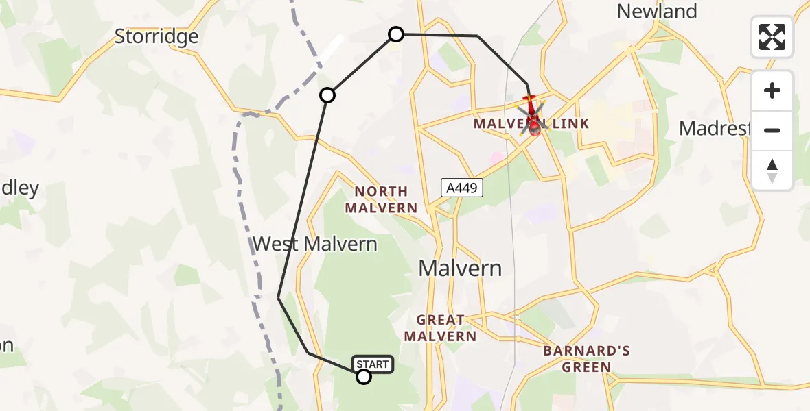
Route
Merton Road, West Midlands - Worcestershire17:12
Malvern, Worcestershire17:11
Crumpton Oaks Farm Airstrip, Storridge17:11
Lower Dingle, West Midlands - Worcestershire17:10
Malvern, Worcestershire16:42
Malvern, West Midlands - Worcestershire16:39
Live flights
Police Helicopter on its way from Glasgow5 Jul 23:05
Today
Air Ambulance Helicopter to North Sea5 Jul 22:14
Police Helicopter to Solihull, Centro Way5 Jul 22:09
Police Helicopter to Hawarden Airport5 Jul 21:47
Air Ambulance Aircraft to North Sea5 Jul 21:33
Police Helicopter to Caergwrle, Stryt Isa5 Jul 21:25
Flights Malvern
Air Ambulance Helicopter to Tong, Airbase Avenue29 May 15:09
Air Ambulance Helicopter to Hill Croome, M55 Apr 17:43
Helicopter flights on your website?
You can easily display helicopter flights on your own website. Use the embed code.
