Air Ambulance Helicopter to Buttermere
Sunday, 5 April 2026 | 15:31 | From Edenhall
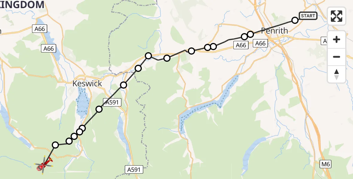
On Sunday, 5 April 2026 at 15:31, a Air Ambulance Helicopter departed from Edenhall to Buttermere. It was the Air Ambulance Helicopter with registration number G-NHAE. The flight lasted 13 minutes. During that period, the aircraft travelled 27 miles at an average speed of 123 miles per hour at a maximum altitude of 3700 feet.
Helicopter: G-NHAE
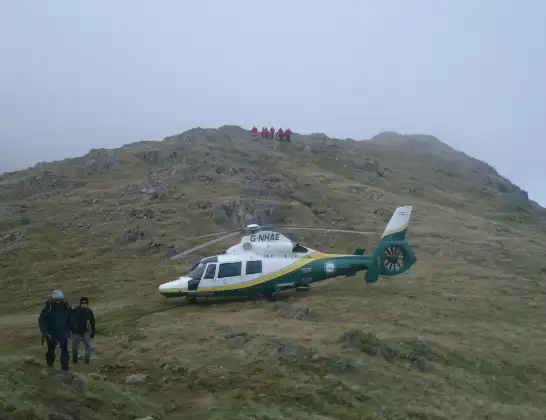
The helicopter G-NHAE is used as a air ambulance helicopter. The main purpose of this aircraft is to transport a Mobile Medical Team to an incident as quickly as possible, enabling the trauma doctor to provide immediate first aid on site. The aircraft is flying this flight as Air Ambulance Helicopter.
Photo: Michael Earnshaw
27 miles
3700 feet
123 mph
14 minutes
15:31
15:44

Route
Buttermere, Cumberland15:44
Buttermere, Cumberland15:43
Borrowdale, Cumberland15:42
Grange, Cumberland15:42
Rosthwaite, Cumberland15:42
Grange, Cumberland15:42
Borrowdale, Cumberland15:41
St. John's Castlerigg and Wythburn, Cumberland15:39
Scales, Westmorland and Furness15:38
Threlkeld, Westmorland and Furness15:38
Scales, Westmorland and Furness15:37
Troutbeck, Westmorland and Furness15:36
Penruddock, Westmorland and Furness15:35
Greystoke, Westmorland and Furness15:35
Newbiggin, Westmorland and Furness15:34
Stainton, Westmorland and Furness15:34
Penrith, Westmorland and Furness15:31
The Avenue, Westmorland and Furness15:31
Live flights
Today
Coastguard Helicopter to Ventnor21:17:52
Flights Buttermere
Air Ambulance Helicopter to Carlisle General31 Mar 15:26
Coastguard Helicopter to Buttermere, B528929 Mar 11:25
Flights Edenhall
Air Ambulance Helicopter to Mungrisdale, A664 Apr 15:07
Air Ambulance Helicopter to Bampton Grange1 Apr 14:26
Air Ambulance Helicopter to Cumberland31 Mar 14:36
Air Ambulance Helicopter to Mungrisdale, A59430 Mar 18:33
Air Ambulance Helicopter to Edenhall4 Mar 12:14
Air Ambulance Helicopter to Culgaith, B64123 Mar 09:39
Helicopter flights on your website?
You can easily display helicopter flights on your own website. Use the embed code.
