Air Ambulance Helicopter to Penrith, A686
Thursday, 2 April 2026 | 10:50 | From Cumberland
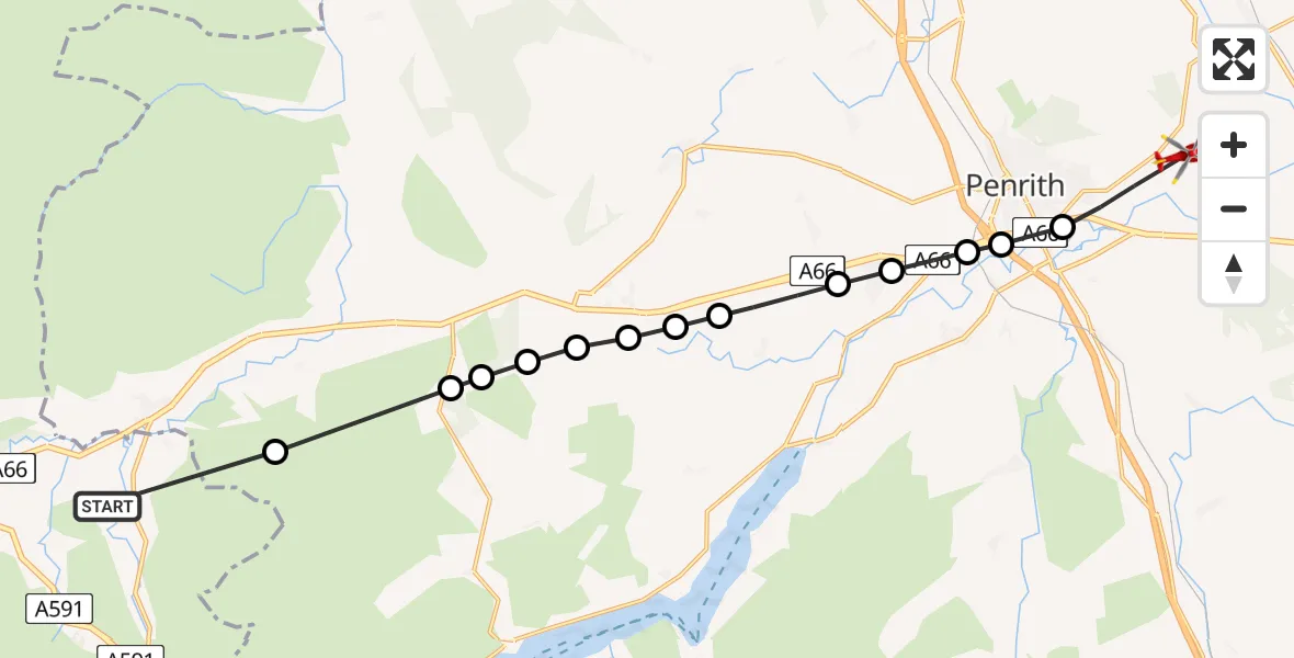
On Thursday, 2 April 2026 at 10:50, a Air Ambulance Helicopter departed from Cumberland to Penrith. It was the Air Ambulance Helicopter with registration number G-NHAE. The flight lasted 6 minutes. During that period, the aircraft travelled 16 miles at an average speed of 148 miles per hour at a maximum altitude of 2300 feet.
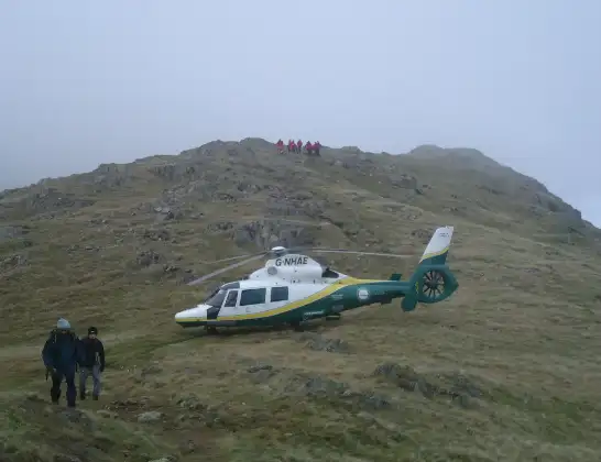
Helicopter: G-NHAE
The helicopter G-NHAE is used as a air ambulance helicopter. The main purpose of this aircraft is to transport a Mobile Medical Team to an incident as quickly as possible, enabling the trauma doctor to provide immediate first aid on site. The aircraft is flying this flight as Air Ambulance Helicopter.
Photo: Michael Earnshaw
16 miles
2300 feet
148 mph
7 minutes
10:50
10:56

Route
A686, Westmorland and Furness10:56
Penrith, Westmorland and Furness10:56
Eamont Bridge, Westmorland and Furness10:55
Dacre, Westmorland and Furness10:55
Stainton, Westmorland and Furness10:55
Newbiggin, Westmorland and Furness10:54
Dacre, Westmorland and Furness10:54
Hutton, Westmorland and Furness10:53
Penruddock, Westmorland and Furness10:53
Motherby, Westmorland and Furness10:53
Cocklakes Hill, Westmorland and Furness10:52
Matterdale End, Westmorland and Furness10:52
Troutbeck, Westmorland and Furness10:52
Threlkeld, Westmorland and Furness10:51
Cumberland, Cumberland10:50
Live flights
Today
Coastguard Helicopter to Solent Airport5 Jul 23:21
Air Ambulance Aircraft to RAF Lossiemouth5 Jul 23:17
Police Helicopter to Glasgow, Beech Avenue5 Jul 23:05
Police Aircraft to East Midlands Airport5 Jul 22:38
Air Ambulance Helicopter to North Sea5 Jul 22:14
Police Helicopter to Solihull, Centro Way5 Jul 22:09
Police Helicopter to Hawarden Airport5 Jul 21:47
Flights Penrith
Air Ambulance Helicopter to Penrith, A6867 Jun 11:35
Air Ambulance Helicopter to Irish Sea5 Jun 15:10
Air Ambulance Helicopter to Penrith, B528823 May 17:04
Air Ambulance Helicopter to Penrith, Langwathby19 May 11:53
Flights Cumberland
Air Ambulance Helicopter to Penrith, A6862 Apr 10:50
Air Ambulance Helicopter to Cumberland2 Apr 10:42
Air Ambulance Helicopter to Cumberland31 Mar 14:36
Helicopter flights on your website?
You can easily display helicopter flights on your own website. Use the embed code.
