Police Helicopter to St. Columb Major, A392
Wednesday, 1 April 2026 | 15:30 | From Towednack
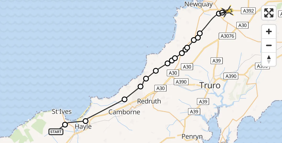
On Wednesday, 1 April 2026 at 15:30, a Police Helicopter departed from Towednack to St. Columb Major. It was the Police Helicopter with registration number G-CPAS. The flight lasted 11 minutes. During that period, the aircraft travelled 27 miles at an average speed of 147 miles per hour at a maximum altitude of 900 feet.
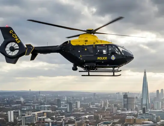
Helicopter: G-CPAS
The helicopter G-CPAS is used by the British police. The helicopter is deployed in pursuits, missing persons cases and other incidents where a helicopter provides added value.
Photo: Tony Melony
28 miles
900 feet
147 mph
12 minutes
15:30
15:41

Route
A392, Cornwall15:41
St. Columb Major, Cornwall15:41
Kestle Mill, Cornwall15:40
St. Newlyn East, Cornwall15:39
Perranzabuloe, Cornwall15:38
Newquay, Cornwall15:38
Goonhavern, Cornwall15:38
Bolingey, Cornwall15:38
Perranzabuloe, Cornwall15:37
Perrancoombe, Cornwall15:37
Perranzabuloe, Cornwall15:37
Perrancoombe, Cornwall15:36
Mount Hawke, Cornwall15:36
Porthtowan, Cornwall15:35
Portreath, Cornwall15:34
Cornwall, Cornwall15:33
Phillack, Cornwall15:31
Carbis Bay, Cornwall15:30
Towednack, Cornwall15:30
Live flights
Police Helicopter on its way from Irlam9 Jul 22:15
Today
Coastguard Helicopter to North Sea9 Jul 22:25
Police Helicopter to Hortham, M59 Jul 22:22
Police Helicopter to MOD St Athan9 Jul 22:18
Coastguard Helicopter to North Sea9 Jul 22:15
Coastguard Helicopter to North Sea9 Jul 22:04
Police Helicopter to Aberdeenshire9 Jul 21:59
Police Helicopter to Bournemouth Airport9 Jul 21:52
Police Helicopter to East Ardsley, M19 Jul 21:52
Flights Towednack
Air Ambulance Helicopter to Derriford Hospital10 Apr 13:15
Air Ambulance Helicopter to Towednack10 Apr 12:13
Police Helicopter to St. Columb Major, A3921 Apr 15:30
Helicopter flights on your website?
You can easily display helicopter flights on your own website. Use the embed code.
