Air Ambulance Helicopter to Tebay, Pikestone Lane
Tuesday, 31 March 2026 | 12:29 | From Westmorland and Furness
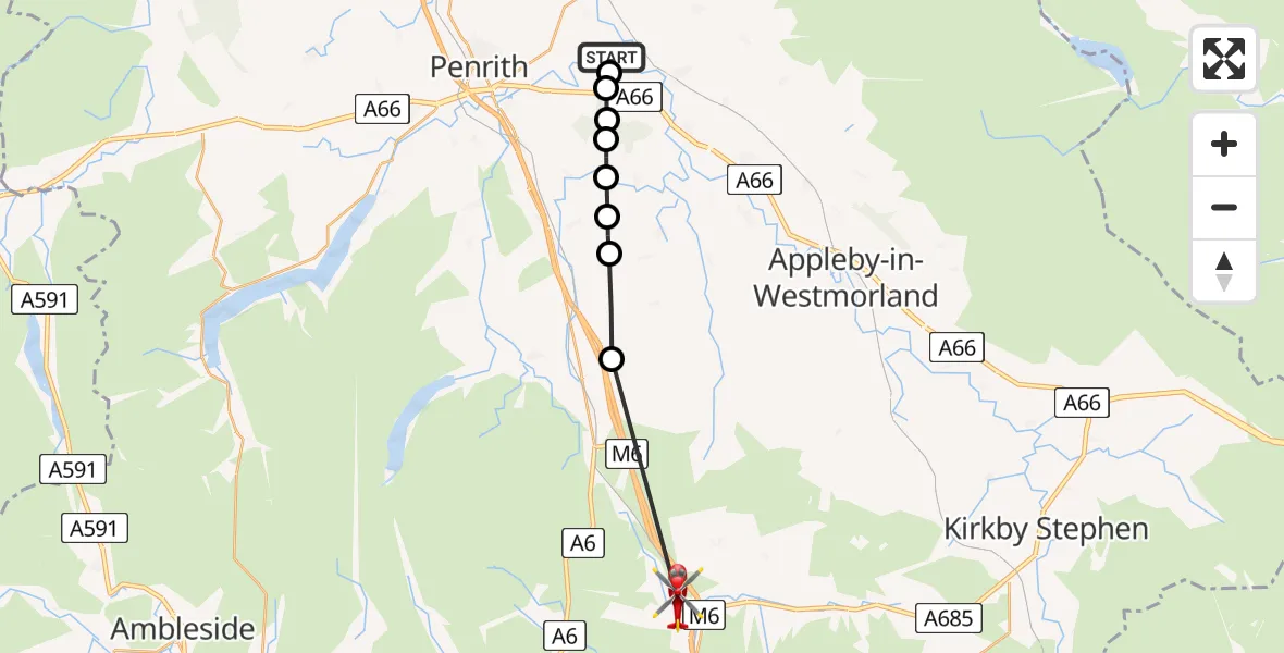
On Tuesday, 31 March 2026 at 12:29, a Air Ambulance Helicopter departed from Westmorland and Furness to Tebay. It was the Air Ambulance Helicopter with registration number G-NHAE. The flight lasted 6 minutes. During that period, the aircraft travelled 16 miles at an average speed of 161 miles per hour at a maximum altitude of 1425 feet.
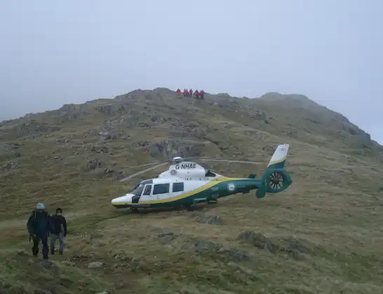
Helicopter: G-NHAE
The helicopter G-NHAE is used as a air ambulance helicopter. The main purpose of this aircraft is to transport a Mobile Medical Team to an incident as quickly as possible, enabling the trauma doctor to provide immediate first aid on site. The aircraft is flying this flight as Air Ambulance Helicopter.
Photo: Michael Earnshaw
16 miles
1425 feet
161 mph
6 minutes
12:29
12:35

Route
Pikestone Lane, Westmorland and Furness12:35
Shap, Westmorland and Furness12:33
Newby, Westmorland and Furness12:32
Great Strickland, Westmorland and Furness12:31
Melkinthorpe, Westmorland and Furness12:31
Fell View, Westmorland and Furness12:30
Centerparcs, Westmorland and Furness12:30
Westmorland and Furness, Westmorland and Furness12:30
RAF Hornby Hall, Penrith, Cumbria12:30
Westmorland and Furness, Westmorland and Furness12:29
Live flights
Today
Police Helicopter to MOD St Athan15 Jul 23:53
Police Helicopter to East Ardsley, Stoney Lane15 Jul 23:36
Flights Tebay
Air Ambulance Helicopter to Old Scotch Road31 Mar 12:36
Helicopter flights on your website?
You can easily display helicopter flights on your own website. Use the embed code.
