Air Ambulance Helicopter to Nuneaton, Sheringham Close
Sunday, 29 March 2026 | 8:32 | From Coventry
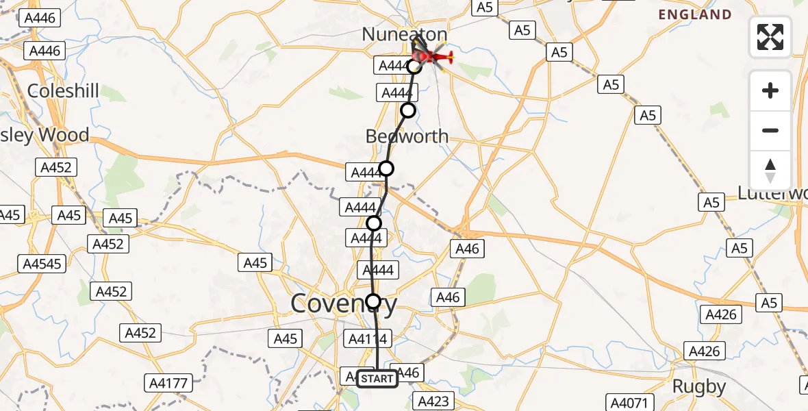
On Sunday, 29 March 2026 at 8:32, a Air Ambulance Helicopter departed from Coventry to Nuneaton. It was the Air Ambulance Helicopter with registration number G-WNAS. The flight lasted 6 minutes. During that period, the aircraft travelled 13 miles at an average speed of 134 miles per hour at a maximum altitude of 825 feet.
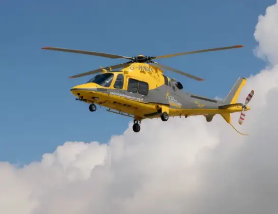
Helicopter: G-WNAS
The helicopter G-WNAS is used as an ambulance helicopter. The helicopter is equipped with a stretcher for transporting patients. The helicopter is often used to transport to hospitals.
Photo: Tony Melony
13 miles
825 feet
134 mph
6 minutes
08:32
08:38

Route
Sheringham Close, West Midlands - Warwickshire08:38
Nuneaton, Warwickshire08:35
Bedworth, Warwickshire08:35
Exhall, Warwickshire08:34
Coventry, Hartlepool08:33
Daimler Green, Hartlepool08:33
Stonebridge Highway, Hartlepool08:32
Live flights
Today
Flights Nuneaton
Air Ambulance Helicopter to Coventry Airport22 Jun 15:08
Air Ambulance Helicopter to Coventry Airport16 Mar 13:18
Air Ambulance Helicopter to Coventry Airport20 Jan 12:59
Flights Coventry
Police Helicopter to Birmingham Airport30 Mar 18:47
Police Helicopter to Coventry, Moat Avenue30 Mar 18:32
Air Ambulance Helicopter to Coventry Airport28 Mar 18:31
Helicopter flights on your website?
You can easily display helicopter flights on your own website. Use the embed code.
