Air Ambulance Helicopter to Nottingham Heliport
Saturday, 28 March 2026 | 12:06 | From Nuthall
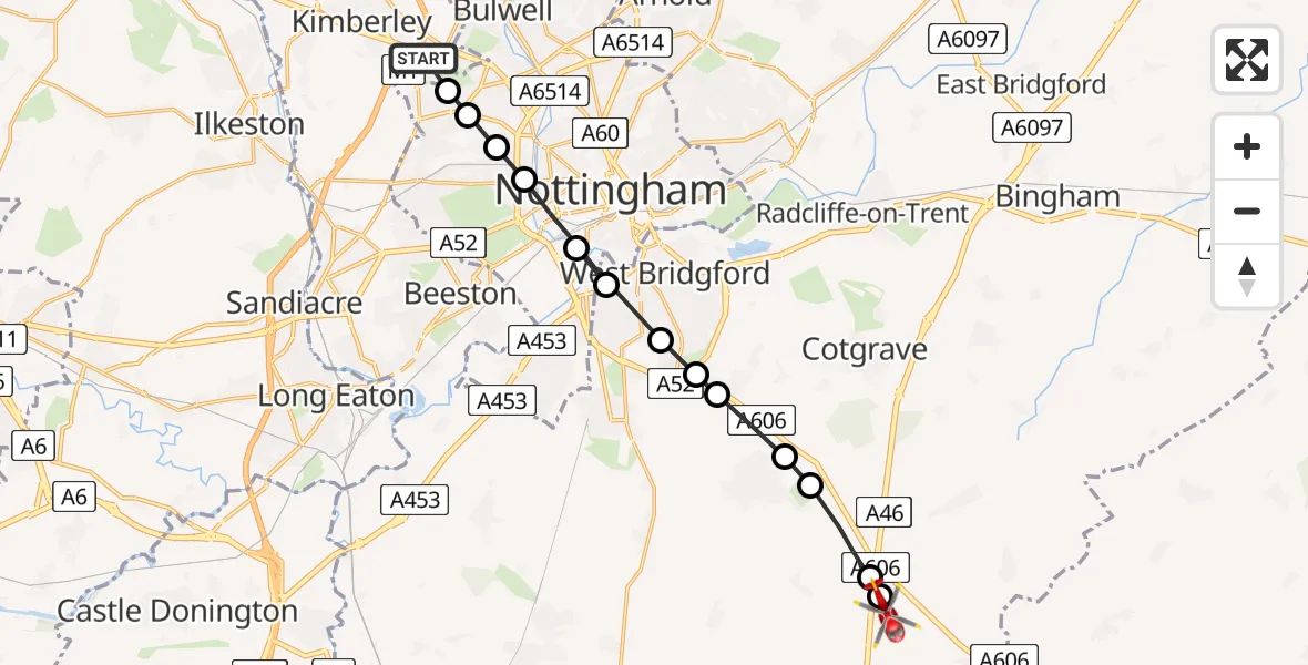
On Saturday, 28 March 2026 at 12:06, a Air Ambulance Helicopter departed from Nuthall to Nottingham Heliport. It was the Air Ambulance Helicopter with registration number G-DRLA. The flight lasted 5 minutes. During that period, the aircraft travelled 15 miles at an average speed of 193 miles per hour at a maximum altitude of 925 feet.
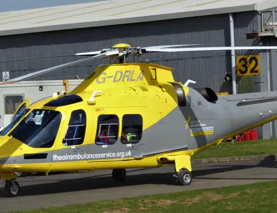
Helicopter: G-DRLA
The helicopter G-DRLA is used as an ambulance helicopter. The helicopter is equipped with a stretcher for transporting patients. The helicopter is often used to transport to hospitals.
Photo: Alec Wilson
16 miles
925 feet
193 mph
5 minutes
12:06
12:11

Route
Nottingham Heliport, 12:11
Rushcliffe, Nottinghamshire12:10
Kinoulton, Nottinghamshire12:10
Stanton on the Wolds, Nottinghamshire12:09
Keyworth, Nottinghamshire12:09
Plumtree, Nottinghamshire12:09
Tollerton, Nottinghamshire12:09
West Bridgford, Nottinghamshire12:08
City of Nottingham, Hartlepool12:08
West Bridgford, Nottinghamshire12:08
City of Nottingham, Hartlepool12:07
Wollaton, Hartlepool12:07
City of Nottingham, Hartlepool12:06
Bulwell, Hartlepool12:06
A610, Nottinghamshire12:06
Live flights
Today
Flights Nuthall
Air Ambulance Helicopter to Bamford, New Road20 Jun 12:06
Air Ambulance Helicopter to Nottingham Heliport28 Mar 12:06
Helicopter flights on your website?
You can easily display helicopter flights on your own website. Use the embed code.
