Air Ambulance Helicopter to Aberdyfi, Parc yr Ysgol
Friday, 27 March 2026 | 17:49 | From Caernarfon Airport
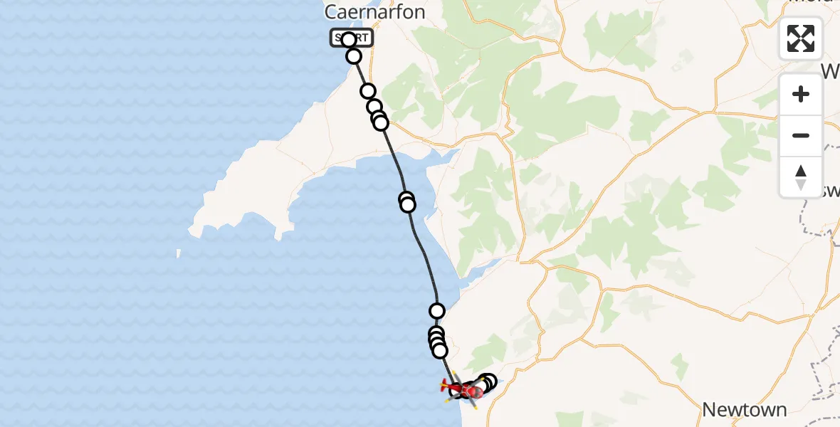
On Friday, 27 March 2026 at 17:49, a Air Ambulance Helicopter departed from Caernarfon Airport to Aberdyfi. It was the Air Ambulance Helicopter with registration number G-WOBR. The flight lasted 26 minutes. During that period, the aircraft travelled 50 miles at an average speed of 118 miles per hour at a maximum altitude of 1100 feet.
Helicopter: G-WOBR
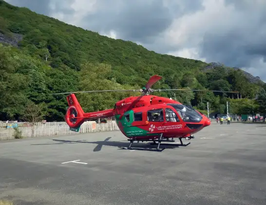
The helicopter G-WOBR is used as a air ambulance helicopter. The main purpose of this aircraft is to transport a Mobile Medical Team to an incident as quickly as possible, enabling the trauma doctor to provide immediate first aid on site. The aircraft is flying this flight as Air Ambulance Helicopter.
Photo: Hefin Owen
51 miles
1100 feet
118 mph
26 minutes
17:49
18:15

Route
Parc yr Ysgol, Gwynedd18:15
Aberdyfi, Gwynedd18:14
A493, Gwynedd18:13
Plas Panteidal, Gwynedd18:13
A493, Gwynedd18:11
Plas Panteidal, Gwynedd18:10
A493, Gwynedd18:08
Aberdyfi, Gwynedd18:08
Tywyn, Gwynedd18:06
Cefncamberth, Gwynedd18:05
Rhoslefain, Gwynedd18:05
Tywyn, Gwynedd18:05
Llwyngwril, Gwynedd18:04
Irish Sea17:59
Sir Ynys Môn, Birmingham17:59
Criccieth, Gwynedd17:56
Bryncir Garden Centre, Gwynedd17:56
Clynnog, Gwynedd17:55
Pant Glas, Gwynedd17:55
Clynnog, Gwynedd17:53
Ger Y Llan, Gwynedd17:52
Dinas Dinlle, Gwynedd17:52
Caernarfon Airport, Caernarfon17:49
Live flights
Police Helicopter on its way from Glasgow5 Jul 23:05
Today
Air Ambulance Helicopter to North Sea5 Jul 22:14
Police Helicopter to Solihull, Centro Way5 Jul 22:09
Police Helicopter to Hawarden Airport5 Jul 21:47
Air Ambulance Aircraft to North Sea5 Jul 21:33
Police Helicopter to Caergwrle, Stryt Isa5 Jul 21:25
Flights Aberdyfi
Air Ambulance Helicopter to Aberdyfi4 Jul 13:17
Air Ambulance Helicopter to Aberdyfi, A4934 Jul 12:21
Air Ambulance Helicopter to Rhyl, Rhuddlan Road27 Jun 15:28
Air Ambulance Helicopter to Moriah, A4430 May 17:44
Air Ambulance Helicopter to Aberdyfi30 May 16:26
Air Ambulance Helicopter to Rhyl, Rhuddlan Road27 Mar 18:43
Helicopter flights on your website?
You can easily display helicopter flights on your own website. Use the embed code.
