Air Ambulance Helicopter to An Tochailt, Ben Alder Road
Friday, 27 March 2026 | 16:34 | From Dalwhinnie
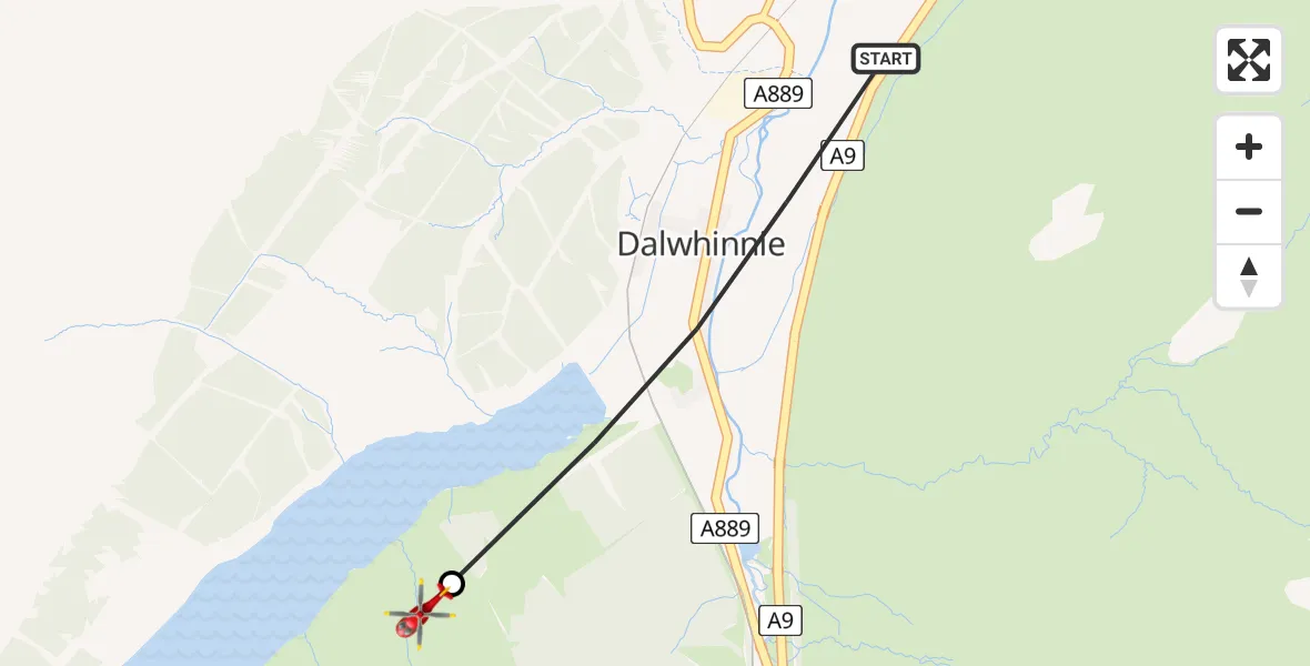
On Friday, 27 March 2026 at 16:34, a Air Ambulance Helicopter departed from Dalwhinnie to An Tochailt. It was the Air Ambulance Helicopter with registration number G-ISAS. The flight lasted 1 minutes. During that period, the aircraft travelled 2 miles at an average speed of 104 miles per hour at a maximum altitude of 2525 feet.
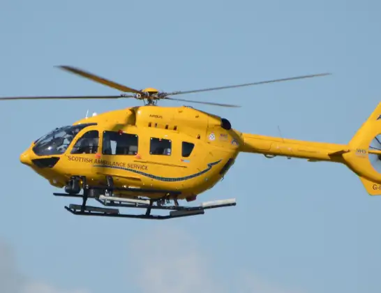
Helicopter: G-ISAS
The helicopter G-ISAS is used as a air ambulance helicopter. The main purpose of this aircraft is to transport a Mobile Medical Team to an incident as quickly as possible, enabling the trauma doctor to provide immediate first aid on site. The aircraft is flying this flight as Air Ambulance Helicopter.
Photo: Jonathan Payne
2 miles
2525 feet
104 mph
2 minutes
16:34
16:35

Route
Ben Alder Road, Highland16:35
An Tochailt, Highland16:35
A9, Highland16:34
Live flights
Police Helicopter on its way from MOD St Athan15 Jul 23:53
Police Helicopter on its way from Wrenthorpe15 Jul 23:36
Today
Police Helicopter to Glasgow, Renfrew Road15 Jul 23:45
Police Helicopter to Manchester Barton Aerodrome15 Jul 23:33
Police Helicopter to Renfrewshire15 Jul 23:32
Air Ambulance Helicopter to Southampton Airport15 Jul 23:30
Police Helicopter to Coopersale, Epping Road15 Jul 23:07
Police Helicopter to Largs, Lane 115 Jul 23:02
Flights Dalwhinnie
Helicopter flights on your website?
You can easily display helicopter flights on your own website. Use the embed code.
