Air Ambulance Helicopter to Egglescliffe, Longnewton Lane
Friday, 27 March 2026 | 13:46 | From Rushyford
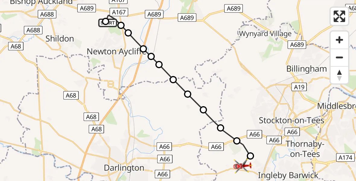
On Friday, 27 March 2026 at 13:46, a Air Ambulance Helicopter departed from Rushyford to Egglescliffe. It was the Air Ambulance Helicopter with registration number G-NHAE. The flight lasted 7 minutes. During that period, the aircraft travelled 13 miles at an average speed of 119 miles per hour at a maximum altitude of 1325 feet.
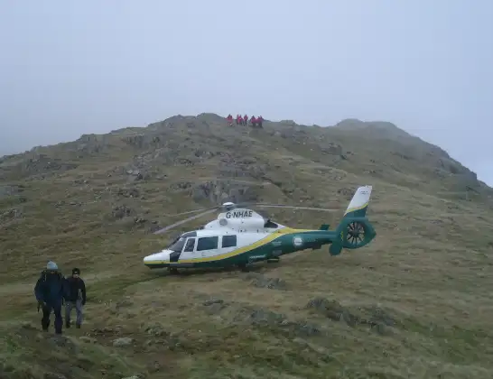
Helicopter: G-NHAE
The helicopter G-NHAE is used as a air ambulance helicopter. The main purpose of this aircraft is to transport a Mobile Medical Team to an incident as quickly as possible, enabling the trauma doctor to provide immediate first aid on site. The aircraft is flying this flight as Air Ambulance Helicopter.
Photo: Michael Earnshaw
14 miles
1325 feet
119 mph
7 minutes
13:46
13:53

Route
Longnewton Lane, Stockton-on-Tees13:53
Egglescliffe, Stockton-on-Tees13:52
Elton, Stockton-on-Tees13:52
Longnewton, Stockton-on-Tees13:51
Bishopton, Darlington13:50
Darlington, Darlington13:50
Elstob Lane, Darlington13:49
Stainton Hill House, County Durham13:49
Carr Lane, County Durham13:49
A1(M), County Durham13:48
Low Copelaw, County Durham13:48
Rushyford, County Durham13:48
Spennymoor, County Durham13:47
Middridge Road, County Durham13:46
Live flights
Police Helicopter on its way from Coopersale6 Jul 22:57
Police Helicopter on its way from Glasgow6 Jul 22:39
Today
Air Ambulance Aircraft to Greenigoe6 Jul 21:45
Coastguard Helicopter to Humberside Airport6 Jul 21:43
Air Ambulance Helicopter to RAF Northolt6 Jul 21:24
Police Helicopter to Birmingham Airport6 Jul 21:17
Police Helicopter to Hawarden Airport6 Jul 20:38
Flights Egglescliffe
Air Ambulance Helicopter to Newton Aycliffe3 Jul 08:45
Flights Rushyford
Air Ambulance Helicopter to Rushyford27 Mar 13:05
Helicopter flights on your website?
You can easily display helicopter flights on your own website. Use the embed code.
