Air Ambulance Helicopter to Cramlington, Northumbria Way
Friday, 27 March 2026 | 12:01 | From Denwick
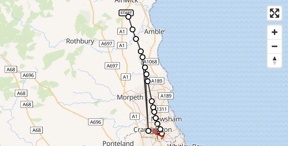
On Friday, 27 March 2026 at 12:01, a Air Ambulance Helicopter departed from Denwick to Cramlington. It was the Air Ambulance Helicopter with registration number G-NHAE. The flight lasted 9 minutes. During that period, the aircraft travelled 45 miles at an average speed of 295 miles per hour at a maximum altitude of 1725 feet.
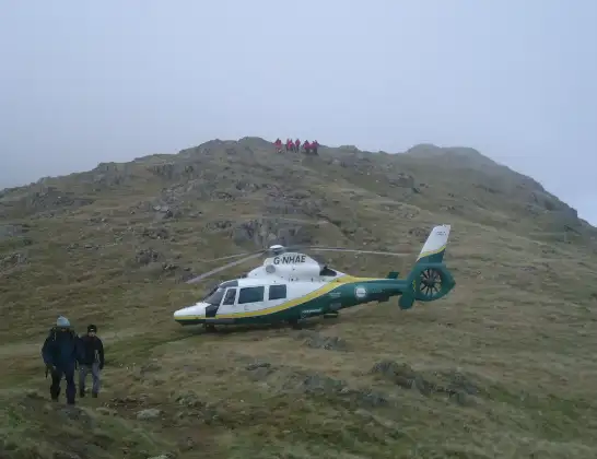
Helicopter: G-NHAE
The helicopter G-NHAE is used as a air ambulance helicopter. The main purpose of this aircraft is to transport a Mobile Medical Team to an incident as quickly as possible, enabling the trauma doctor to provide immediate first aid on site. The aircraft is flying this flight as Air Ambulance Helicopter.
Photo: Michael Earnshaw
46 miles
1725 feet
295 mph
10 minutes
12:01
12:10

Route
Northumbria Way, North East12:10
Cramlington, North East12:09
Seaton Delaval, Newsham12:09
East Hartford, Cramlington12:08
East Hartford, Blyth12:08
Bebside, Bedlington12:07
Bedlington Station, North East12:07
Guide Post, North East12:07
Ashington, North East12:06
Ulgham, North East12:05
Stobswood, North East12:05
Cramlington, North East12:04
Red Row, North East12:04
Tritlington and West Chevington, North East12:04
Acklington, North East12:03
Newton-on-the-Moor and Swarland, North East12:02
Shilbottle, North East12:01
A1, North East12:01
Live flights
Today
Police Helicopter to Glasgow, South Street6 Jul 23:22
Police Helicopter to South Lanarkshire6 Jul 23:09
Police Helicopter to North Weald Airfield6 Jul 22:57
Police Aircraft to East Midlands Airport6 Jul 22:56
Police Helicopter to Lochhead, A726 Jul 22:39
Flights Cramlington
Air Ambulance Helicopter to Egglescliffe, A6730 May 10:43
Air Ambulance Helicopter to Egglescliffe20 Apr 19:54
Air Ambulance Helicopter to West Allen18 Apr 15:20
Flights Denwick
Air Ambulance Helicopter to Langwathby, B641215 Jun 12:50
Police Helicopter to Eshott Airfield8 Jun 11:38
Police Helicopter to Denwick, Hinding Lane8 Jun 10:49
Air Ambulance Helicopter to Denwick, A121 May 14:57
Helicopter flights on your website?
You can easily display helicopter flights on your own website. Use the embed code.
