Air Ambulance Helicopter to Rushwick
Friday, 27 March 2026 | 7:27 | From Earl's Croome
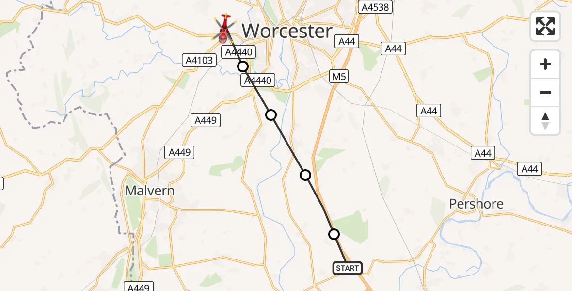
On Friday, 27 March 2026 at 7:27, a Air Ambulance Helicopter departed from Earl's Croome to Rushwick. It was the Air Ambulance Helicopter with registration number G-OMAA. The flight lasted 4 minutes. During that period, the aircraft travelled 9 miles at an average speed of 131 miles per hour at a maximum altitude of 800 feet.
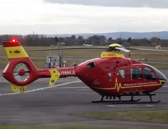
Helicopter: G-OMAA
The helicopter G-OMAA is used as a air ambulance helicopter. The main purpose of this aircraft is to transport a Mobile Medical Team to an incident as quickly as possible, enabling the trauma doctor to provide immediate first aid on site. The aircraft is flying this flight as Air Ambulance Helicopter.
Photo: James from Cheltenham, Gloucestershire
9 miles
800 feet
131 mph
5 minutes
07:27
07:32

Route
Rushwick, Malvern Hills07:32
Rushwick, Malvern Hills07:31
Rushwick, Malvern Hills07:30
Powick, Malvern Hills07:30
Kempsey, Malvern Hills07:29
Severn Stoke, Malvern Hills07:28
M5, Malvern Hills07:27
Today
Coastguard Helicopter to Solent Airport5 Jul 23:21
Air Ambulance Aircraft to RAF Lossiemouth5 Jul 23:17
Police Helicopter to Glasgow, Beech Avenue5 Jul 23:05
Police Aircraft to East Midlands Airport5 Jul 22:38
Air Ambulance Helicopter to North Sea5 Jul 22:14
Police Helicopter to Solihull, Centro Way5 Jul 22:09
Police Helicopter to Hawarden Airport5 Jul 21:47
Flights Rushwick
Police Helicopter to Birmingham Airport22 Apr 23:37
Air Ambulance Helicopter to Rushwick27 Mar 07:27
Helicopter flights on your website?
You can easily display helicopter flights on your own website. Use the embed code.
