Air Ambulance Helicopter to Oldland Common, Bath Road
Thursday, 26 March 2026 | 19:01 | From Bromham
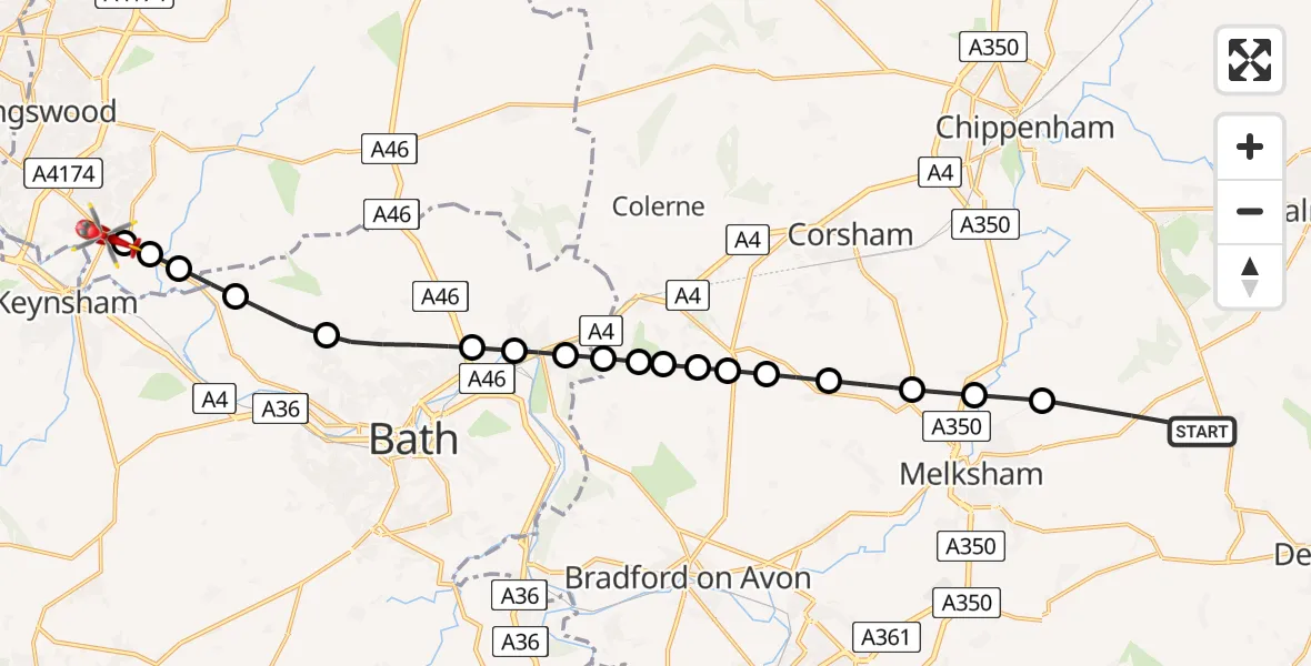
On Thursday, 26 March 2026 at 19:01, a Air Ambulance Helicopter departed from Bromham to Oldland Common. It was the Air Ambulance Helicopter with registration number G-DSAA. The flight lasted 13 minutes. During that period, the aircraft travelled 19 miles at an average speed of 89 miles per hour at a maximum altitude of 1150 feet.
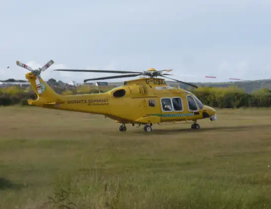
Helicopter: G-DSAA
The helicopter G-DSAA is used as a air ambulance helicopter. The main purpose of this aircraft is to transport a Mobile Medical Team to an incident as quickly as possible, enabling the trauma doctor to provide immediate first aid on site. The aircraft is flying this flight as Air Ambulance Helicopter.
Photo: Andrew Bone
20 miles
1150 feet
89 mph
14 minutes
19:01
19:14

Route
Bath Road, West of England19:14
Oldland Common, West of England19:14
Bitton, West of England19:13
Upton Cheyney, West of England19:13
North Stoke, West of England19:12
Charlcombe, West of England19:11
Bath, West of England19:10
Batheaston, West of England19:09
Bathford, West of England19:08
Bathford, West of England19:08
Lower Wraxall, Lower Wraxall19:08
Monkton Farleigh, Monkton Farleigh19:07
Box, Box19:07
Lower Wraxall, Lower Wraxall19:07
Neston, Neston19:06
Atworth, Atworth19:05
Whitley, Whitley19:04
Beanacre, Beanacre19:03
Melksham, Melksham19:03
Hawkstreet, Bromham19:01
Live flights
Today
Flights Bromham
Air Ambulance Helicopter to Lower Compton21 May 20:02
Helicopter flights on your website?
You can easily display helicopter flights on your own website. Use the embed code.
