Air Ambulance Helicopter to Pity Me, Woodward Way
Thursday, 26 March 2026 | 17:36 | From Stockton-on-Tees
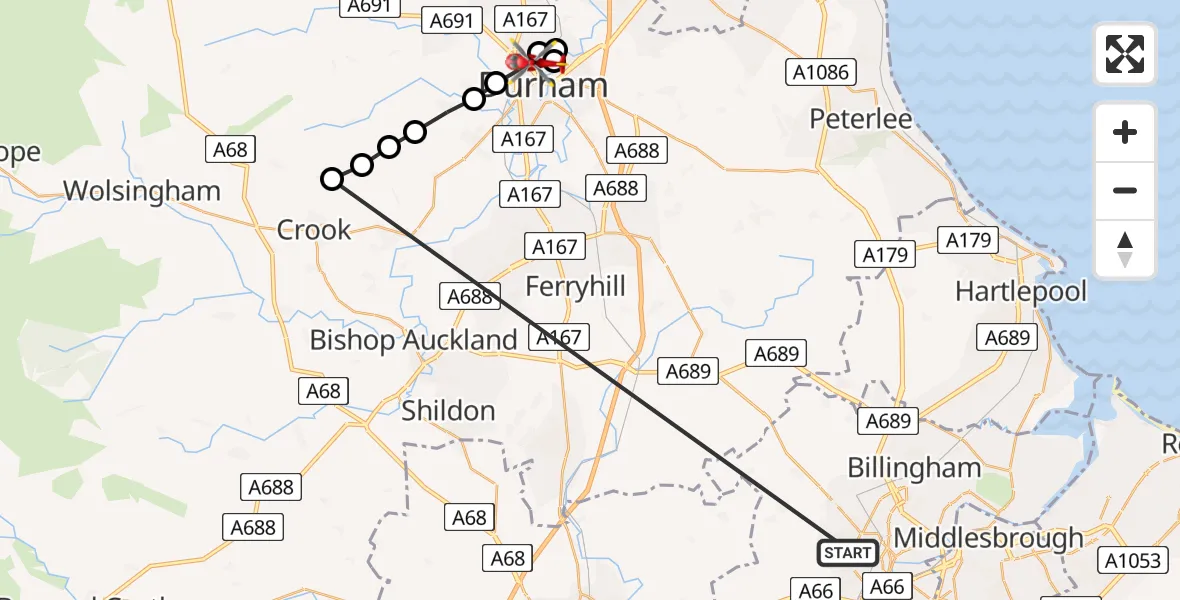
On Thursday, 26 March 2026 at 17:36, a Air Ambulance Helicopter departed from Stockton-on-Tees to Pity Me. It was the Air Ambulance Helicopter with registration number G-NHAE. The flight lasted 5 minutes. During that period, the aircraft travelled 28 miles at an average speed of 348 miles per hour at a maximum altitude of 1550 feet.
Helicopter: G-NHAE
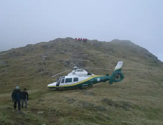
The helicopter G-NHAE is used as a air ambulance helicopter. The main purpose of this aircraft is to transport a Mobile Medical Team to an incident as quickly as possible, enabling the trauma doctor to provide immediate first aid on site. The aircraft is flying this flight as Air Ambulance Helicopter.
Photo: Michael Earnshaw
29 miles
1550 feet
348 mph
5 minutes
17:36
17:40

Route
Woodward Way, Durham17:40
Durham, North East17:40
Framwellgate Moor, North East17:39
Pity Me, Durham17:39
Durham, North East17:38
Ushaw Moor, North East17:38
New Brancepeth, North East17:37
Durham, North East17:37
Brancepeth, North East17:36
Stanley Crook, North East17:36
Bishopton Road West, Tees Valley17:36
Today
Flights Stockton-on-Tees
Air Ambulance Helicopter to Milburn25 Jun 21:23
Helicopter flights on your website?
You can easily display helicopter flights on your own website. Use the embed code.
