Air Ambulance Aircraft to Lossiemouth, B9040
Wednesday, 25 March 2026 | 20:40 | From Aberdeen City
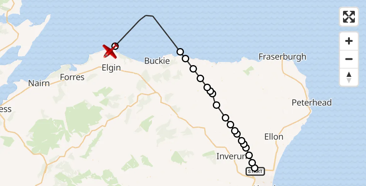
On Wednesday, 25 March 2026 at 20:40, a Air Ambulance Aircraft departed from Aberdeen City to Lossiemouth. It was the Air Ambulance Aircraft with registration number G-SASC. The flight lasted 22 minutes. During that period, the aircraft travelled 69 miles at an average speed of 187 miles per hour at a maximum altitude of 6050 feet.
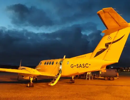
Helicopter: G-SASC
The aircraft G-SASC is used as an air ambulance aircraft. The main purpose of this aircraft is to transport a Mobile Medical Team to an incident as quickly as possible, enabling the trauma doctor to provide immediate first aid on site. The aircraft is flying this flight as Air Ambulance Aircraft.
Photo: Mike Pennington
69 miles
6050 feet
187 mph
23 minutes
20:40
21:02

Route
B9040, Lossiemouth21:02
Lossiemouth, Lossiemouth21:01
North Sea20:53
Sandend, Sandend20:52
Portsoy, Portsoy20:51
Blackhills, Blackhills20:50
Aberchirder, Aberchirder20:49
Bridgend, Bridgend20:49
Bogton, Bogton20:48
Turriff, Turriff20:47
Kirkton of Auchterless, Kirkton of Auchterless20:46
Fyvie, Fyvie20:45
St Katherines, St Katherines20:45
Tulloch, Tulloch20:44
St Katherines, St Katherines20:43
Oldmeldrum, Oldmeldrum20:43
Kirkton of Bourtie, Kirkton of Bourtie20:43
Keithhall, Keithhall20:42
Newmachar, Newmachar20:41
Cothal, Cothal20:40
Pitmedden Road, Aberdeen City20:40
Live flights
Today
Flights Lossiemouth
Air Ambulance Aircraft to Lossiemouth, B904029 Mar 12:01
Air Ambulance Aircraft to Lossiemouth, B904027 Mar 21:08
Air Ambulance Aircraft to Lossiemouth, B904025 Mar 20:40
Air Ambulance Aircraft to Lossiemouth, B904022 Mar 03:57
Air Ambulance Aircraft to Lossiemouth, B904018 Mar 20:16
Air Ambulance Aircraft to Lossiemouth, B904010 Mar 21:09
Air Ambulance Aircraft to Lossiemouth, B904010 Mar 18:04
Helicopter flights on your website?
You can easily display helicopter flights on your own website. Use the embed code.
