Air Ambulance Helicopter to Uttoxeter, Bridge Road
Wednesday, 25 March 2026 | 13:17 | From South Staffordshire
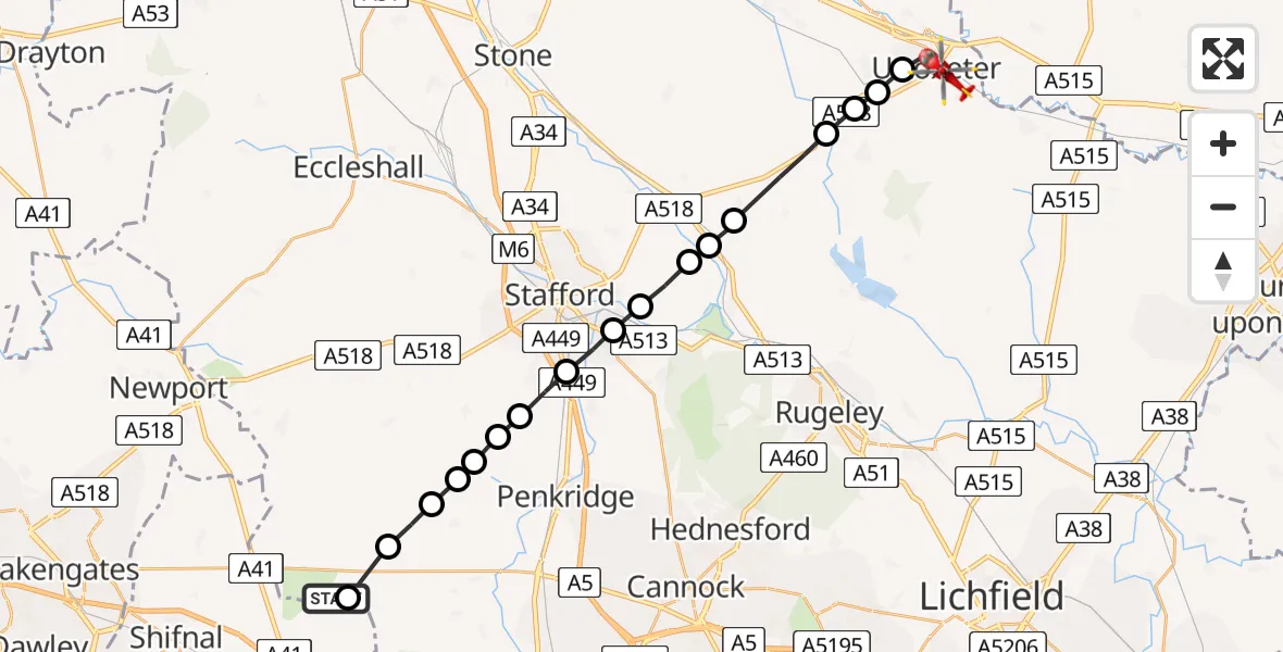
On Wednesday, 25 March 2026 at 13:17, a Air Ambulance Helicopter departed from South Staffordshire to Uttoxeter. It was the Air Ambulance Helicopter with registration number G-SCAA. The flight lasted 10 minutes. During that period, the aircraft travelled 23 miles at an average speed of 139 miles per hour at a maximum altitude of 1275 feet.
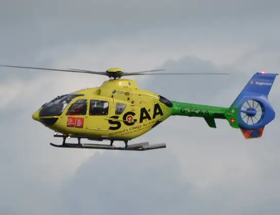
Helicopter: G-SCAA
The helicopter G-SCAA is used as a air ambulance helicopter. The main purpose of this aircraft is to transport a Mobile Medical Team to an incident as quickly as possible, enabling the trauma doctor to provide immediate first aid on site. The aircraft is flying this flight as Air Ambulance Helicopter.
Photo: Jonathan Payne
24 miles
1275 feet
139 mph
11 minutes
13:17
13:27

Route
Bridge Road, East Staffordshire13:27
Uttoxeter, East Staffordshire13:26
Bramshall, Uttoxeter13:26
Bramshall, East Staffordshire13:25
Kingstone, East Staffordshire13:25
Stowe-by-Chartley, Stafford13:24
Hixon, Stafford13:23
Great Haywood, Stafford13:23
Tixall, Stafford13:22
Walton on the Hill, Stafford13:22
Stafford, Stafford13:21
Coppenhall, South Staffordshire13:20
Bradley, Stafford13:20
Bradley, Penkridge13:19
Mitton Airstrip13:19
Lapley, South Staffordshire13:19
Wheaton Aston, South Staffordshire13:18
Tong, Tong13:17
South Staffordshire, South Staffordshire13:17
Live flights
Today
Flights Uttoxeter
Helicopter flights on your website?
You can easily display helicopter flights on your own website. Use the embed code.
