Air Ambulance Helicopter to Caverswall, Roughcote Lane
Wednesday, 25 March 2026 | 8:36 | From Weston under Lizard
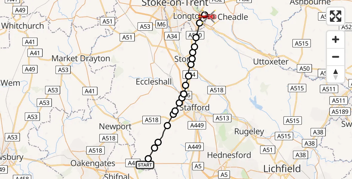
On Wednesday, 25 March 2026 at 8:36, a Air Ambulance Helicopter departed from Weston under Lizard to Caverswall. It was the Air Ambulance Helicopter with registration number G-SCAA. The flight lasted 10 minutes. During that period, the aircraft travelled 23 miles at an average speed of 136 miles per hour at a maximum altitude of 1550 feet.
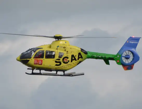
Helicopter: G-SCAA
The helicopter G-SCAA is used as a air ambulance helicopter. The main purpose of this aircraft is to transport a Mobile Medical Team to an incident as quickly as possible, enabling the trauma doctor to provide immediate first aid on site. The aircraft is flying this flight as Air Ambulance Helicopter.
Photo: Jonathan Payne
24 miles
1550 feet
136 mph
11 minutes
08:36
08:46

Route
Roughcote Lane, Staffordshire Moorlands08:46
Caverswall, Staffordshire Moorlands08:45
Longton, Stoke-on-Trent08:45
Meir Heath, Stafford08:44
Moddershall, Stafford08:43
Oulton, Stafford08:43
Oulton, Stone08:42
Stone, Stone08:42
Aston-by-Stone, Stafford08:41
Stafford, Stafford08:41
Creswell, Stafford08:40
Derrington, Stafford08:40
Seighford, Stafford08:40
Derrington, Stafford08:39
Stafford, Stafford08:39
Haughton, Stafford08:38
Church Eaton, Stafford08:37
Stafford, Stafford08:37
Blymhill, South Staffordshire08:36
Watling Street, South Staffordshire08:36
Live flights
Flights Caverswall
Helicopter flights on your website?
You can easily display helicopter flights on your own website. Use the embed code.
