Air Ambulance Helicopter to Tibshelf, Silverhill Trail
Tuesday, 24 March 2026 | 15:27 | From Widmerpool
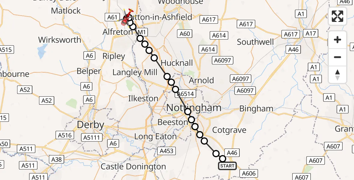
On Tuesday, 24 March 2026 at 15:27, a Air Ambulance Helicopter departed from Widmerpool to Tibshelf. It was the Air Ambulance Helicopter with registration number G-DRLA. The flight lasted 11 minutes. During that period, the aircraft travelled 25 miles at an average speed of 143 miles per hour at a maximum altitude of 1625 feet.
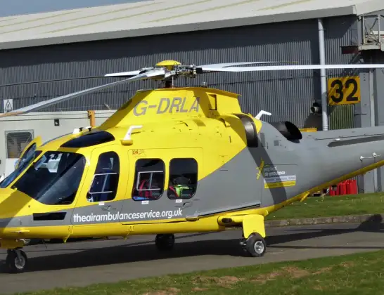
Helicopter: G-DRLA
The helicopter G-DRLA is used as an ambulance helicopter. The helicopter is equipped with a stretcher for transporting patients. The helicopter is often used to transport to hospitals.
Photo: Alec Wilson
26 miles
1625 feet
143 mph
11 minutes
15:27
15:38

Route
Silverhill Trail, Bolsover15:38
Blackwell, Bolsover15:37
Tibshelf, Bolsover15:36
Blackwell, Bolsover15:36
South Normanton, Bolsover15:36
Pinxton, Bolsover15:35
Selston CP, City of Nottingham15:34
Selston CP, Ashfield15:34
Underwood, Ashfield15:34
Greasley, Broxtowe15:33
Bulwell, City of Nottingham15:32
Nuthall, Broxtowe15:32
City of Nottingham, City of Nottingham15:31
Wilford, City of Nottingham15:30
West Bridgford, Rushcliffe15:30
Ruddington, West Bridgford15:29
Ruddington, Rushcliffe15:29
Keyworth, Rushcliffe15:28
Stanton on the Wolds, Rushcliffe15:28
Penn Lane, Rushcliffe15:27
Live flights
Today
Police Helicopter to Glasgow, South Street6 Jul 23:22
Police Helicopter to South Lanarkshire6 Jul 23:09
Police Helicopter to North Weald Airfield6 Jul 22:57
Police Aircraft to East Midlands Airport6 Jul 22:56
Police Helicopter to Lochhead, A726 Jul 22:39
Flights Tibshelf
Flights Widmerpool
Air Ambulance Helicopter to Carsington Water4 Jul 11:57
Air Ambulance Helicopter to Mansfield1 Jul 17:09
Helicopter flights on your website?
You can easily display helicopter flights on your own website. Use the embed code.
