Police Helicopter to South Nutfield, Crab Hill Lane
Tuesday, 24 March 2026 | 14:38 | From Crowborough
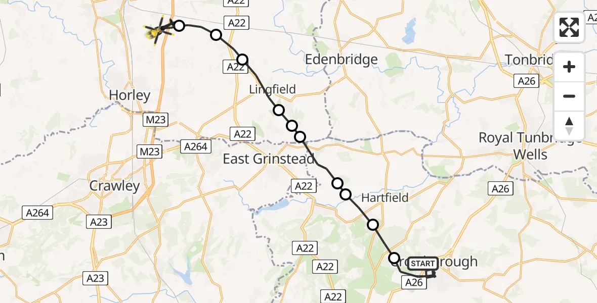
On Tuesday, 24 March 2026 at 14:38, a Police Helicopter departed from Crowborough to South Nutfield. It was the Police Helicopter with registration number G-POLH. The flight lasted 15 minutes. During that period, the aircraft travelled 21 miles at an average speed of 84 miles per hour at a maximum altitude of 1200 feet.
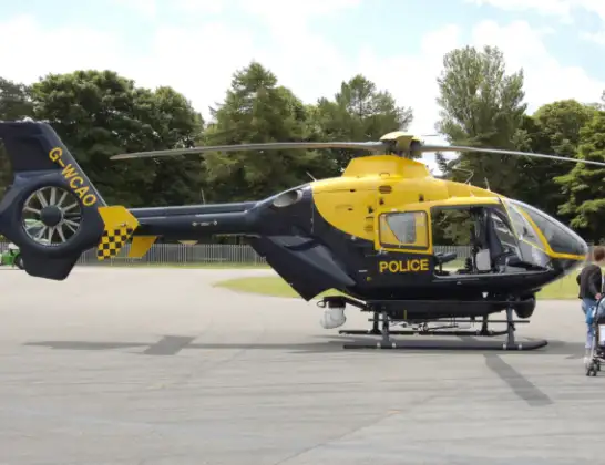
Helicopter: G-POLH
The helicopter G-POLH is used by the British police. The helicopter is deployed in pursuits, missing persons cases and other incidents where a helicopter provides added value.
Photo: Arpingstone
22 miles
1200 feet
84 mph
16 minutes
14:38
14:53

Route
Crab Hill Lane, South Nutfield14:53
South Nutfield, South Nutfield14:52
Tandridge, Tandridge14:51
Blindley Heath, Blindley Heath14:50
Lingfield, Lingfield14:49
Dormans Park, Dormans Park14:48
Tandridge, Tandridge14:48
Wealden, Wealden14:46
Hartfield, Wealden14:46
Upper Hartfield, Wealden14:45
Wealden, Wealden14:44
Beacon Road West, Wealden14:38
Live flights
Today
Police Helicopter to Glasgow, South Street6 Jul 23:22
Police Helicopter to South Lanarkshire6 Jul 23:09
Police Helicopter to North Weald Airfield6 Jul 22:57
Police Aircraft to East Midlands Airport6 Jul 22:56
Police Helicopter to Lochhead, A726 Jul 22:39
Flights Crowborough
Air Ambulance Helicopter to Wealden, Crowborough15 Jun 20:47
Air Ambulance Helicopter to Redhill Aerodrome14 May 22:56
Air Ambulance Helicopter to Redhill Aerodrome14 May 11:57
Police Helicopter to Thorpe Arnold, Saxby Road25 Apr 15:31
Helicopter flights on your website?
You can easily display helicopter flights on your own website. Use the embed code.
