Police Helicopter to Rooksbridge, M5
Monday, 23 March 2026 | 23:01 | From Brent Knoll
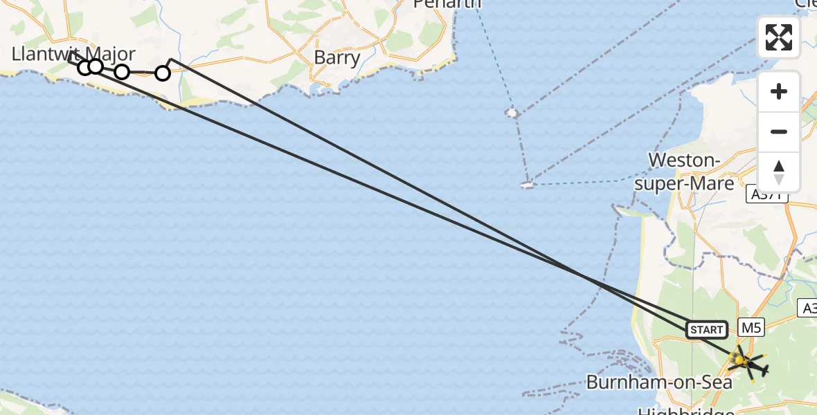
On Monday, 23 March 2026 at 23:01, a Police Helicopter departed from Brent Knoll to Rooksbridge. It was the Police Helicopter with registration number G-NWOI. The flight lasted 5 minutes. During that period, the aircraft travelled 53 miles at an average speed of 658 miles per hour at a maximum altitude of 775 feet.
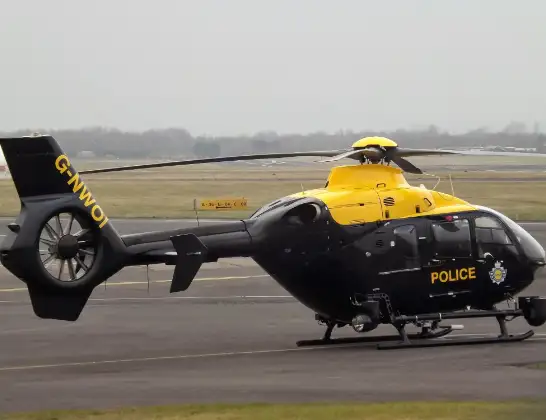
Helicopter: G-NWOI
The helicopter G-NWOI is used by the British police. The helicopter is deployed in pursuits, missing persons cases and other incidents where a helicopter provides added value.
Photo: James from Cheltenham
53 miles
775 feet
658 mph
5 minutes
23:01
23:06

Route
M5, Rooksbridge23:06
St Athan, St Athan23:05
MOD St Athan, St Athan, Vale of Glamorgan23:04
Boverton, Boverton23:03
Llantwit Major, Llantwit Major23:02
Burton Row, Brent Knoll23:01
Live flights
Police Helicopter on its way from Ewelme13 Jul 22:24
Today
Police Helicopter to Bournemouth Airport13 Jul 23:55
Air Ambulance Helicopter to Cardiff Heliport13 Jul 23:38
Police Helicopter to Birmingham Airport13 Jul 23:21
Police Helicopter to Irlam, Twelve Yards Road13 Jul 23:00
Flights Rooksbridge
Police Helicopter to MOD St Athan30 May 20:08
Police Helicopter to MOD St Athan5 May 15:09
Police Helicopter to Rooksbridge, M523 Mar 23:01
Helicopter flights on your website?
You can easily display helicopter flights on your own website. Use the embed code.
