Air Ambulance Helicopter to Uckfield, Bell Farm Road
Sunday, 22 March 2026 | 14:04 | From Redhill Aerodrome
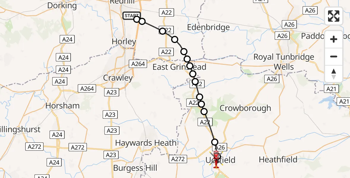
On Sunday, 22 March 2026 at 14:04, a Air Ambulance Helicopter departed from Redhill Aerodrome to Uckfield. It was the Air Ambulance Helicopter with registration number G-LNAC. The flight lasted 11 minutes. During that period, the aircraft travelled 22 miles at an average speed of 116 miles per hour at a maximum altitude of 1250 feet.
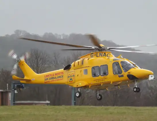
Helicopter: G-LNAC
The helicopter G-LNAC is used as a air ambulance helicopter. The main purpose of this aircraft is to transport a Mobile Medical Team to an incident as quickly as possible, enabling the trauma doctor to provide immediate first aid on site. The aircraft is flying this flight as Air Ambulance Helicopter.
Photo: James from Cheltenham, Gloucestershire
22 miles
1250 feet
116 mph
12 minutes
14:04
14:15

Route
Bell Farm Road, Wealden14:15
Uckfield, Wealden14:14
Maresfield, Wealden14:13
Nutley, Wealden14:12
Upper Hartfield, Wealden14:11
Wealden, Wealden14:11
Forest Row, Wealden14:10
Ashurst Wood, Mid Sussex14:10
East Grinstead, Mid Sussex14:10
Dormans Park, Dormans Park14:09
Dormansland, Dormansland14:09
Lingfield, Lingfield14:08
Blindley Heath, Blindley Heath14:07
Outwood, Outwood14:06
Tandridge, Tandridge14:06
Redhill Aerodrome, Redhill, Surrey14:06
Redhill Aerodrome, Redhill, Surrey14:04
Live flights
Today
Flights Uckfield
Helicopter flights on your website?
You can easily display helicopter flights on your own website. Use the embed code.
