Air Ambulance Helicopter to Wingate, Green Lane
Friday, 20 March 2026 | 18:14 | From Aislaby
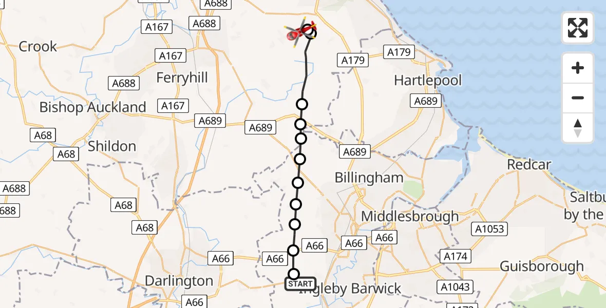
On Friday, 20 March 2026 at 18:14, a Air Ambulance Helicopter departed from Aislaby to Wingate. It was the Air Ambulance Helicopter with registration number G-NHAE. The flight lasted 7 minutes. During that period, the aircraft travelled 16 miles at an average speed of 144 miles per hour at a maximum altitude of 950 feet.
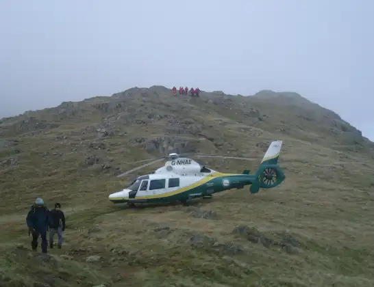
Helicopter: G-NHAE
The helicopter G-NHAE is used as a air ambulance helicopter. The main purpose of this aircraft is to transport a Mobile Medical Team to an incident as quickly as possible, enabling the trauma doctor to provide immediate first aid on site. The aircraft is flying this flight as Air Ambulance Helicopter.
Photo: Michael Earnshaw
17 miles
950 feet
144 mph
7 minutes
18:14
18:21

Route
Green Lane, North East18:21
Wingate, North East18:21
Station Town, North East18:20
Wingate, North East18:18
Sedgefield, North East18:18
Wynyard, Tees Valley18:17
Grindon and Thorpe Thewles, Tees Valley18:17
Thorpe Thewles, Tees Valley18:17
Carlton, Tees Valley18:16
Redmarshall, Tees Valley18:16
Elton, Tees Valley18:15
Longnewton, Tees Valley18:15
A67, Tees Valley18:14
Live flights
Today
Police Aircraft to East Midlands Airport7 Jul 22:05
Flights Wingate
Air Ambulance Helicopter to Egglescliffe20 Mar 18:50
Air Ambulance Helicopter to Wingate, Green Lane20 Mar 18:14
Flights Aislaby
Air Ambulance Helicopter to Egglescliffe27 Jun 15:31
Air Ambulance Helicopter to Egglescliffe, A6722 Jun 11:40
Air Ambulance Helicopter to Ingleton, B62558 Apr 13:57
Air Ambulance Helicopter to Bowes, Bowes Road29 Mar 10:53
Air Ambulance Helicopter to Corsenside23 Mar 16:01
Helicopter flights on your website?
You can easily display helicopter flights on your own website. Use the embed code.
