Coastguard Helicopter to Invergordon
Friday, 20 March 2026 | 15:37 | From Inverness Airport
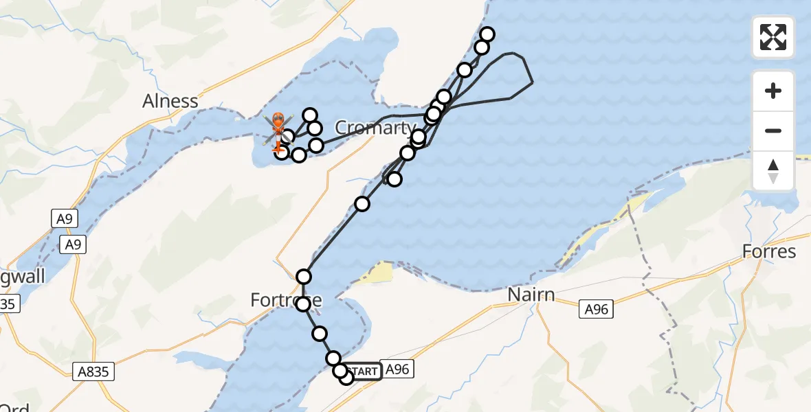
On Friday, 20 March 2026 at 15:37, a Coastguard Helicopter departed from Inverness Airport to Invergordon. It was the Coastguard Helicopter with registration number G-MCGX. The flight lasted 42 minutes. During that period, the aircraft travelled 49 miles at an average speed of 69 miles per hour at a maximum altitude of 1450 feet.
Helicopter: G-MCGX
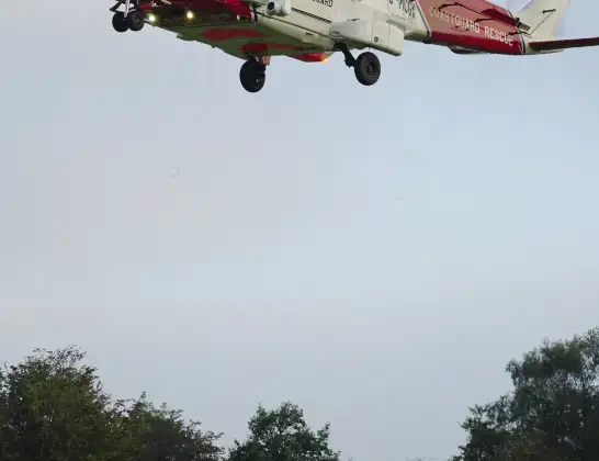
The helicopter G-MCGX is used by the British Coastguard. The helicopter is deployed in search and rescue operations at sea, rescue operations involving ships or drilling platforms, patrols to prevent smuggling or piracy, environmental monitoring and disaster relief support.
Photo: Nick (UK)
49 miles
1450 feet
69 mph
43 minutes
15:37
16:19

Route
Invergordon, Invergordon16:19
Invergordon, Invergordon16:19
Shore Mill, Shore Mill16:18
Barbaraville, Barbaraville16:15
Jemimaville, Jemimaville16:13
Cromarty, Cromarty16:13
Shore Mill, Shore Mill16:12
Cromarty, Cromarty16:09
North Sea16:05
Shandwick, Shandwick16:04
North Sea16:03
Cromarty, Cromarty16:02
Castlecraig, Castlecraig16:02
North Sea16:02
Cromarty, Cromarty16:01
North Sea16:00
Cromarty, Cromarty15:56
North Sea15:43
Cromarty, Cromarty15:41
Rosemarkie, Rosemarkie15:40
Fortrose, Fortrose15:39
Rosemarkie, Rosemarkie15:39
Inverness, Inverness15:38
Dalcross Heliport15:38
Fresson Circle, Inverness15:38
Inverness Airport, Inverness15:37
Live flights
Today
Police Helicopter to Manchester Barton Aerodrome13 Jul 23:56
Police Helicopter to Bournemouth Airport13 Jul 23:55
Air Ambulance Helicopter to Cardiff Heliport13 Jul 23:38
Police Helicopter to Harborough, Sulby Road13 Jul 23:36
Police Helicopter to Birmingham Airport13 Jul 23:21
Flights Invergordon
Air Ambulance Helicopter to Dalcross Heliport27 May 20:42
Coastguard Helicopter to Invergordon21 Apr 23:27
Air Ambulance Helicopter to Highland16 Apr 11:42
Coastguard Helicopter to Inverness Airport20 Mar 16:21
Coastguard Helicopter to Invergordon20 Mar 15:37
Helicopter flights on your website?
You can easily display helicopter flights on your own website. Use the embed code.
