Police Helicopter to Cassop, Ponteland Road
Friday, 20 March 2026 | 12:57 | From Newcastle International Airport
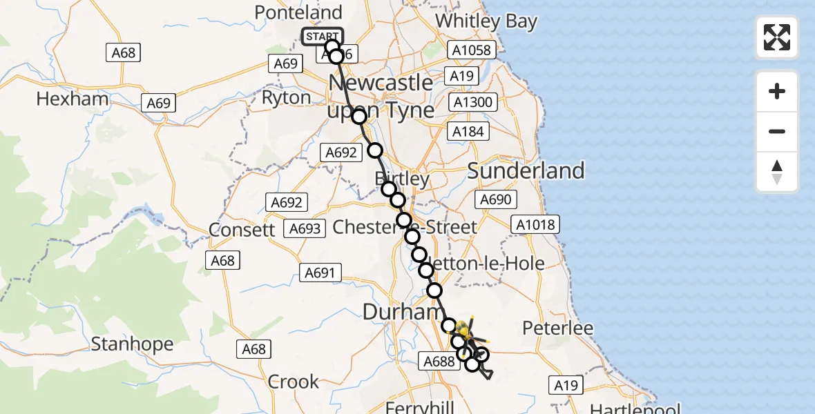
On Friday, 20 March 2026 at 12:57, a Police Helicopter departed from Newcastle International Airport to Cassop. It was the Police Helicopter with registration number G-POLA. The flight lasted 25 minutes. During that period, the aircraft travelled 28 miles at an average speed of 68 miles per hour at a maximum altitude of 1075 feet.
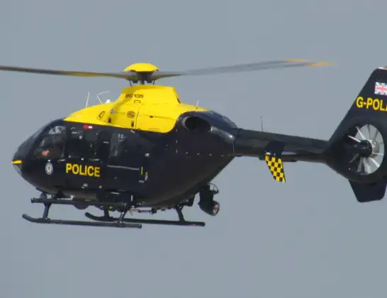
Helicopter: G-POLA
The helicopter G-POLA is used by the British police. The helicopter is deployed in pursuits, missing persons cases and other incidents where a helicopter provides added value.
Photo: ozz13x
28 miles
1075 feet
68 mph
25 minutes
12:57
13:22

Route
Cassop, North East13:12
Thornley, North East13:11
Kelloe, North East13:08
Quarrington Hill, North East13:08
Cassop, North East13:07
Sherburn, North East13:07
Carrville, North East13:05
Framwellgate Moor, North East13:05
Great Lumley, North East13:04
Chester-le-Street, North East13:04
South Pelaw, Chester-le-Street13:03
South Pelaw, Durham13:03
Chester-le-Street, North East13:02
Lamesley, Gateshead13:01
Whickham, North East13:00
Newcastle upon Tyne, North East12:58
Newcastle upon Tyne, Newcastle upon Tyne12:58
Ponteland Road, Newcastle upon Tyne12:57
Live flights
Today
Police Helicopter to Manchester Barton Aerodrome13 Jul 23:56
Police Helicopter to Bournemouth Airport13 Jul 23:55
Air Ambulance Helicopter to Cardiff Heliport13 Jul 23:38
Police Helicopter to Harborough, Sulby Road13 Jul 23:36
Police Helicopter to Birmingham Airport13 Jul 23:21
Police Helicopter to Irlam, Twelve Yards Road13 Jul 23:00
Flights Cassop
Police Helicopter to Cassop, Ponteland Road20 Mar 12:57
Helicopter flights on your website?
You can easily display helicopter flights on your own website. Use the embed code.
