Air Ambulance Helicopter to Tintagel, Bossiney Road
Thursday, 19 March 2026 | 21:44 | From Cornwall Airport Newquay
On Thursday, 19 March 2026 at 21:44, a Air Ambulance Helicopter departed from Cornwall Airport Newquay to Tintagel. It was the Air Ambulance Helicopter with registration number G-CRWL. The flight lasted 12 minutes. During that period, the aircraft travelled 21 miles at an average speed of 105 miles per hour at a maximum altitude of 1125 feet.
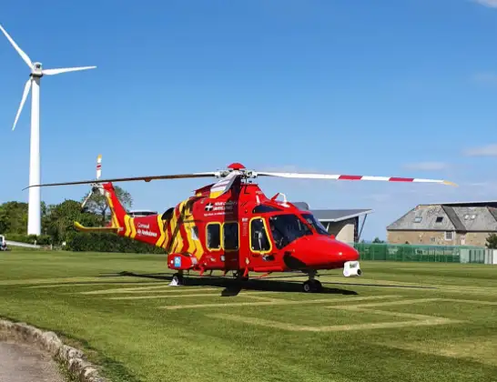
Helicopter: G-CRWL
The helicopter G-CRWL is used as a air ambulance helicopter. The main purpose of this aircraft is to transport a Mobile Medical Team to an incident as quickly as possible, enabling the trauma doctor to provide immediate first aid on site. The aircraft is flying this flight as Air Ambulance Helicopter.
Photo: Jowaninpensans
22 miles
1125 feet
105 mph
13 minutes
21:44
21:56

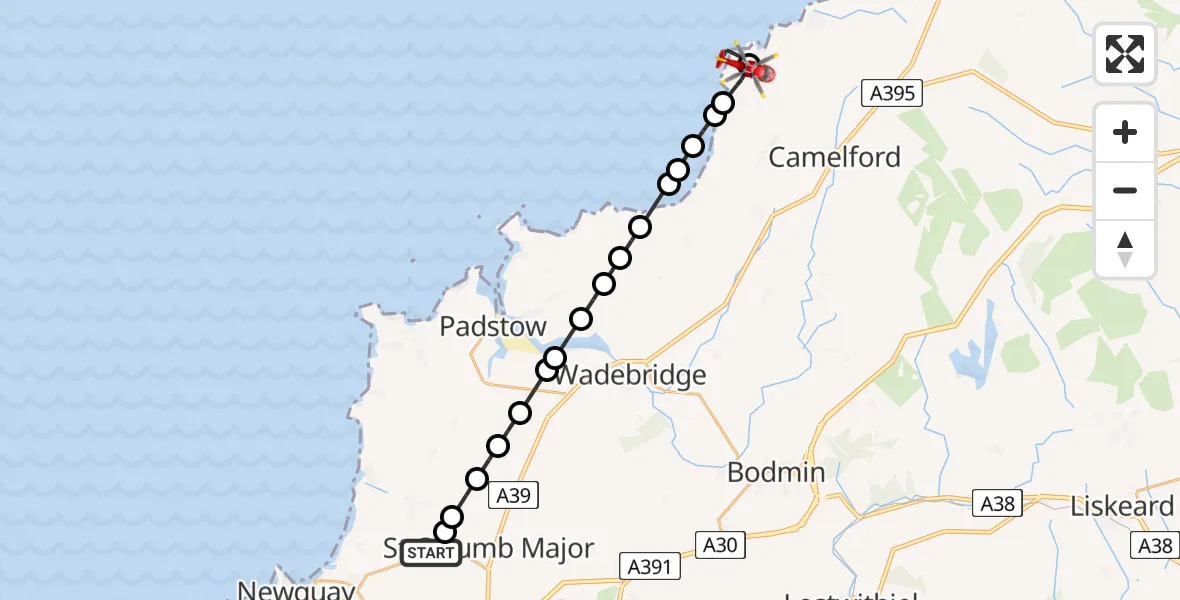
Route
Bossiney Road, Tintagel21:56
Tintagel, Tintagel21:53
Treknow, Treknow21:52
Trebarwith Strand, Trebarwith Strand21:52
Treligga, Treligga21:51
Port Isaac, Port Isaac21:51
Bristol Channel21:51
Port Isaac, Port Isaac21:50
St. Endellion, St. Endellion21:49
Chapel Amble, Chapel Amble21:49
St Minver, St Minver21:48
St. Breock, St. Breock21:48
St. Issey, St. Issey21:48
St Issey, St Issey21:47
St. Issey, St. Issey21:46
St. Columb Major, St. Columb Major21:46
Talskiddy, St. Columb Major21:45
St. Columb Major, St. Columb Major21:45
Cornwall Airport Newquay, Newquay21:44
Live flights
Air Ambulance Helicopter on its way from Ashford14 Jul 23:46
Coastguard Helicopter on its way from North Sea14 Jul 23:44
Today
Police Helicopter to Johnstone, Gordon Square14 Jul 23:38
Coastguard Helicopter to North Sea14 Jul 23:30
Police Helicopter to Inner Seas14 Jul 23:12
Air Ambulance Helicopter to Norwich Airport14 Jul 22:52
Police Helicopter to Manchester Barton Aerodrome14 Jul 22:50
Police Helicopter to Sewardstonebury, Bury Road14 Jul 22:44
Air Ambulance Helicopter to Cardiff Heliport14 Jul 22:43
Flights Tintagel
Coastguard Helicopter to Boscastle, New Road26 Jan 12:43
Coastguard Helicopter to Tintagel, Ocean Cove26 Jan 12:38
Coastguard Helicopter to Tintagel, Bossiney Road26 Jan 12:33
Coastguard Helicopter to Tintagel, B326326 Jan 12:28
Coastguard Helicopter to Tintagel, B326326 Jan 12:24
Coastguard Helicopter to Tintagel, B326326 Jan 12:17
Helicopter flights on your website?
You can easily display helicopter flights on your own website. Use the embed code.
