Air Ambulance Helicopter to Somerton, Walton Drove
Thursday, 19 March 2026 | 20:37 | From Henstridge
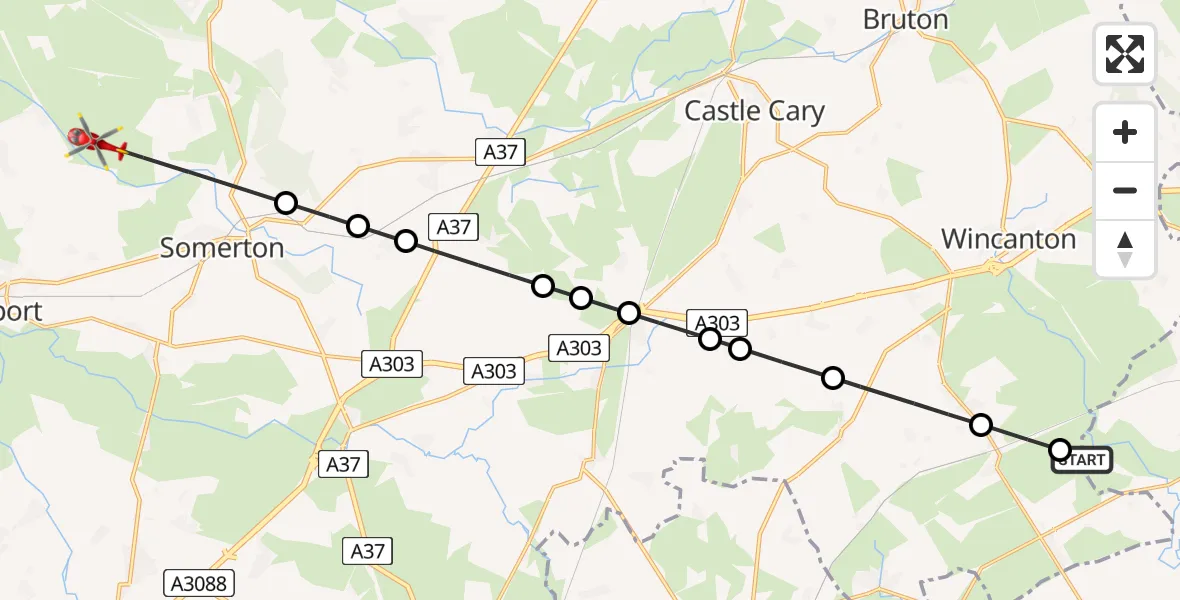
On Thursday, 19 March 2026 at 20:37, a Air Ambulance Helicopter departed from Henstridge to Somerton. It was the Air Ambulance Helicopter with registration number G-DSAA. The flight lasted 8 minutes. During that period, the aircraft travelled 18 miles at an average speed of 131 miles per hour at a maximum altitude of 1350 feet.
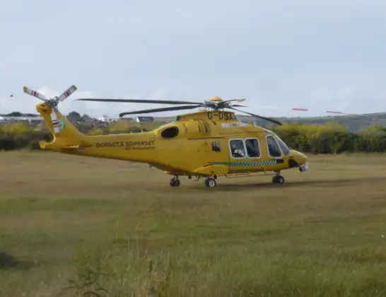
Helicopter: G-DSAA
The helicopter G-DSAA is used as a air ambulance helicopter. The main purpose of this aircraft is to transport a Mobile Medical Team to an incident as quickly as possible, enabling the trauma doctor to provide immediate first aid on site. The aircraft is flying this flight as Air Ambulance Helicopter.
Photo: Andrew Bone
19 miles
1350 feet
131 mph
9 minutes
20:37
20:45

Route
Walton Drove, Somerton20:45
Somerton, Somerton20:43
Charlton Mackrell, Charlton Mackrell20:43
Charlton Adam, Charlton Adam20:42
Babcary, Babcary20:41
South Barrow, South Barrow20:41
Sparkford, Sparkford20:40
South Cadbury, South Cadbury20:40
Compton Pauncefoot, Compton Pauncefoot20:39
Blackford, Blackford20:39
South Cheriton, South Cheriton20:38
Throop Road, Templecombe20:37
Templecombe, Templecombe20:37
Henstridge, Henstridge20:37
Live flights
Today
Flights Somerton
Flights Henstridge
Air Ambulance Helicopter to Pulham16 Apr 22:58
Helicopter flights on your website?
You can easily display helicopter flights on your own website. Use the embed code.
