Police Helicopter to Clydach, Gellionen Road
Thursday, 19 March 2026 | 18:06 | From Llanmaes
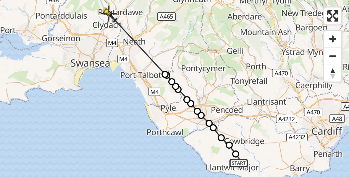
On Thursday, 19 March 2026 at 18:06, a Police Helicopter departed from Llanmaes to Clydach. It was the Police Helicopter with registration number G-NWOI. The flight lasted 11 minutes. During that period, the aircraft travelled 28 miles at an average speed of 148 miles per hour at a maximum altitude of 1250 feet.
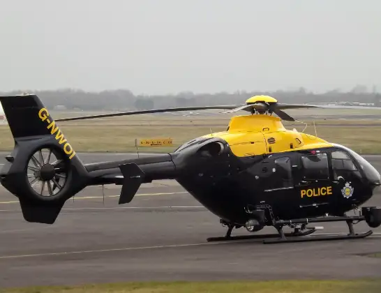
Helicopter: G-NWOI
The helicopter G-NWOI is used by the British police. The helicopter is deployed in pursuits, missing persons cases and other incidents where a helicopter provides added value.
Photo: James from Cheltenham
28 miles
1250 feet
148 mph
12 minutes
18:06
18:17

Route
Gellionen Road, Clydach18:17
Margam, Margam18:13
Bryn, Bryn18:12
Margam, Margam18:12
Pen y Bryn, Pen y Bryn18:12
Llangynwyd, Llangynwyd18:11
Llangynwyd Lower, Llangynwyd Lower18:11
Aberkenfig, Aberkenfig18:10
Pen-y-fai, Pen-y-fai18:10
Newcastle, Newcastle18:09
Bridgend, Bridgend18:09
Corntown, Corntown18:08
Colwinston, Colwinston18:08
Llysworney, Llysworney18:07
Sigingstone, Sigingstone18:07
Tyle House Close, Llanmaes18:06
Live flights
Today
Flights Clydach
Police Helicopter to Clydach, Gellionen Road19 Mar 18:06
Air Ambulance Helicopter to Dafen, Heol Aur3 Feb 15:34
Flights Llanmaes
Police Helicopter to MOD St Athan27 May 20:50
Police Helicopter to St Athan, West Aberthaw27 May 19:26
Police Helicopter to MOD St Athan27 May 10:09
Police Helicopter to MOD St Athan26 May 09:47
Police Helicopter to Gileston25 May 16:11
Police Helicopter to Newton24 May 19:17
Police Helicopter to Boverton, B426521 May 16:12
Police Helicopter to Almondsbury Helicopter Base21 May 11:17
Police Helicopter to Abercynon, Park View17 May 19:34
Helicopter flights on your website?
You can easily display helicopter flights on your own website. Use the embed code.
