Air Ambulance Helicopter to Moira, Old Navigation Place
Thursday, 19 March 2026 | 11:16 | From Rushcliffe
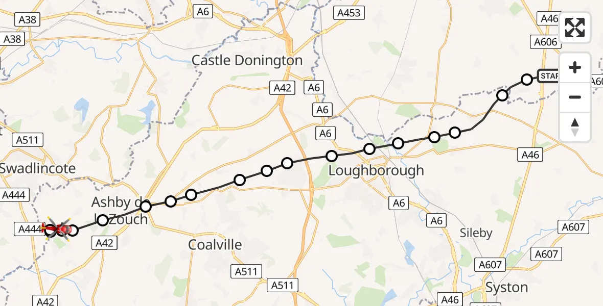
On Thursday, 19 March 2026 at 11:16, a Air Ambulance Helicopter departed from Rushcliffe to Moira. It was the Air Ambulance Helicopter with registration number G-DRLA. The flight lasted 10 minutes. During that period, the aircraft travelled 24 miles at an average speed of 140 miles per hour at a maximum altitude of 750 feet.
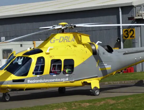
Helicopter: G-DRLA
The helicopter G-DRLA is used as an ambulance helicopter. The helicopter is equipped with a stretcher for transporting patients. The helicopter is often used to transport to hospitals.
Photo: Alec Wilson
25 miles
750 feet
140 mph
11 minutes
11:16
11:26

Route
Old Navigation Place, North West Leicestershire11:26
Moira, North West Leicestershire11:26
Overseal, North West Leicestershire11:25
Moira, North West Leicestershire11:24
Willesley, North West Leicestershire11:24
Willesley, Ashby-de-la-Zouch11:24
Ashby-de-la-Zouch, North West Leicestershire11:23
Coleorton, North West Leicestershire11:22
Worthington, North West Leicestershire11:22
Osgathorpe, North West Leicestershire11:21
Charnwood, Charnwood11:21
Shepshed, Charnwood11:21
Garendon Park, Charnwood11:20
Loughborough, Charnwood11:19
Cotes, Charnwood11:19
Hoton, Charnwood11:18
Charnwood, Charnwood11:18
Wymeswold, Charnwood11:17
Willoughby on the Wolds, Rushcliffe11:16
Folly Hall Lane, East Midlands11:16
Live flights
Today
Police Helicopter to Glasgow, South Street6 Jul 23:22
Police Helicopter to South Lanarkshire6 Jul 23:09
Police Helicopter to North Weald Airfield6 Jul 22:57
Police Aircraft to East Midlands Airport6 Jul 22:56
Police Helicopter to Lochhead, A726 Jul 22:39
Flights Moira
Air Ambulance Helicopter to Rushcliffe, A4620 Jun 17:57
Flights Rushcliffe
Air Ambulance Helicopter to Rushcliffe, A461 Jul 18:42
Air Ambulance Helicopter to Ashwell, Oakham30 Jun 12:44
Air Ambulance Helicopter to Rushcliffe, A4629 Jun 11:54
Air Ambulance Helicopter to East Carlton, A42727 Jun 11:00
Air Ambulance Helicopter to Ab Kettleby26 Jun 11:47
Helicopter flights on your website?
You can easily display helicopter flights on your own website. Use the embed code.
