Police Helicopter to Stirling, Hillfoots Road
Thursday, 19 March 2026 | 10:15 | From Forteviot
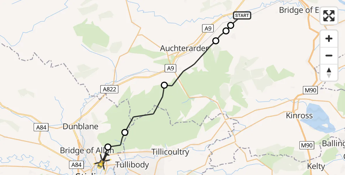
On Thursday, 19 March 2026 at 10:15, a Police Helicopter departed from Forteviot to Stirling. It was the Police Helicopter with registration number G-BZRS. The flight lasted 8 minutes. During that period, the aircraft travelled 21 miles at an average speed of 150 miles per hour at a maximum altitude of 2700 feet.
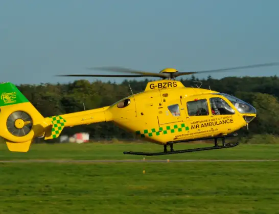
Helicopter: G-BZRS
The helicopter G-BZRS is used by the British police. The helicopter is deployed in pursuits, missing persons cases and other incidents where a helicopter provides added value.
Photo: NMOS332
21 miles
2700 feet
150 mph
9 minutes
10:15
10:24

Route
Hillfoots Road, Stirling10:24
Blairlogie, Blairlogie10:23
Stirling, Stirling10:22
Blackford, Blackford10:20
Auchterarder, Auchterarder10:17
Dunning, Dunning10:16
Perth, Perth10:16
Forteviot, Forteviot10:15
Live flights
Today
Police Helicopter to Glasgow, South Street6 Jul 23:22
Police Helicopter to South Lanarkshire6 Jul 23:09
Police Helicopter to North Weald Airfield6 Jul 22:57
Police Aircraft to East Midlands Airport6 Jul 22:56
Police Helicopter to Lochhead, A726 Jul 22:39
Flights Stirling
Coastguard Helicopter to Killin, Stirling22 Jun 14:48
Coastguard Helicopter to Killin, Stirling22 Jun 14:24
Coastguard Helicopter to Stirling, A8421 Jun 16:32
Police Helicopter to Stirling, A9074 Jun 15:39
Coastguard Helicopter to Stirling26 May 18:44
Coastguard Helicopter to Stirling24 May 18:05
Coastguard Helicopter to Perth and Kinross24 May 14:29
Flights Forteviot
Police Helicopter to Forteviot28 Jun 16:19
Police Helicopter to Forteviot25 Jun 13:26
Police Helicopter to Forteviot24 Jun 13:03
Police Helicopter to Forteviot, B911226 May 18:34
Police Helicopter to Forteviot, B93530 Apr 14:16
Police Helicopter to Forteviot, Henhill Road30 Apr 14:06
Police Helicopter to Forteviot, B93524 Apr 10:53
Police Helicopter to Forteviot, B93510 Apr 17:53
Police Helicopter to Forteviot27 Mar 18:38
Police Helicopter to Stirling, Hillfoots Road19 Mar 10:15
Helicopter flights on your website?
You can easily display helicopter flights on your own website. Use the embed code.
