Air Ambulance Helicopter to Trefechan, Ffrwd Road
Thursday, 19 March 2026 | 8:50 | From Cardiff Heliport
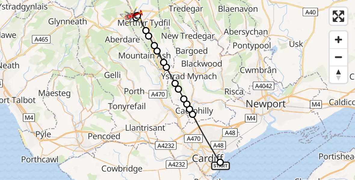
On Thursday, 19 March 2026 at 8:50, a Air Ambulance Helicopter departed from Cardiff Heliport to Trefechan. It was the Air Ambulance Helicopter with registration number G-WROL. The flight lasted 16 minutes. During that period, the aircraft travelled 24 miles at an average speed of 94 miles per hour at a maximum altitude of 1275 feet.
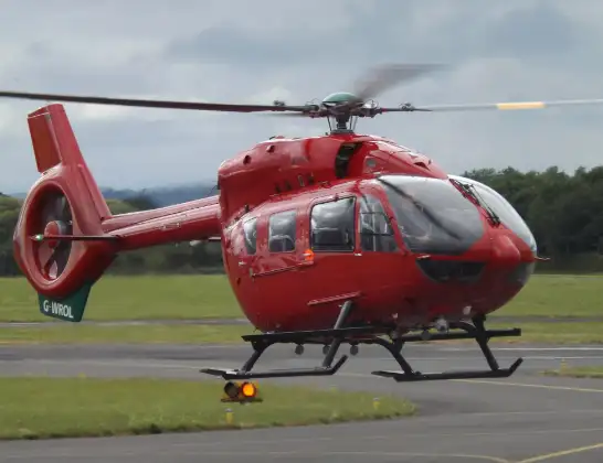
Helicopter: G-WROL
The helicopter G-WROL is used as a air ambulance helicopter. The main purpose of this aircraft is to transport a Mobile Medical Team to an incident as quickly as possible, enabling the trauma doctor to provide immediate first aid on site. The aircraft is flying this flight as Air Ambulance Helicopter.
Photo: James from Cheltenham, Gloucestershire
25 miles
1275 feet
94 mph
16 minutes
08:50
09:05

Route
Ffrwd Road, Trefechan09:05
Trefechan, Trefechan09:05
Merthyr Tydfil, Merthyr Tydfil09:04
Trefechan, Trefechan09:04
Merthyr Tydfil, Merthyr Tydfil09:03
Abercanaid, Abercanaid09:02
Aberfan, Aberfan09:02
Merthyr Vale, Merthyr Vale09:02
Treharris, Treharris09:01
Quakers Yard, Quakers Yard09:00
Nelson, Nelson08:59
Senghenydd, Senghenydd08:59
Abertridwr, Abertridwr08:58
Penyrheol, Penyrheol08:58
Trecenydd, Trecenydd08:58
Caerphilly, Caerphilly08:57
Singleton Road, Cardiff08:54
Cardiff, Cardiff08:54
Cardiff Heliport, Cardiff08:50
Live flights
Today
Police Helicopter to Falkirk02:12:08
Flights Trefechan
Police Helicopter to MOD St Athan4 Feb 18:32
Police Helicopter to Trefechan, Lôn Maes Du4 Feb 18:01
Helicopter flights on your website?
You can easily display helicopter flights on your own website. Use the embed code.
