Air Ambulance Helicopter to Manton, Uppingham Road
Wednesday, 18 March 2026 | 15:15 | From Rushcliffe
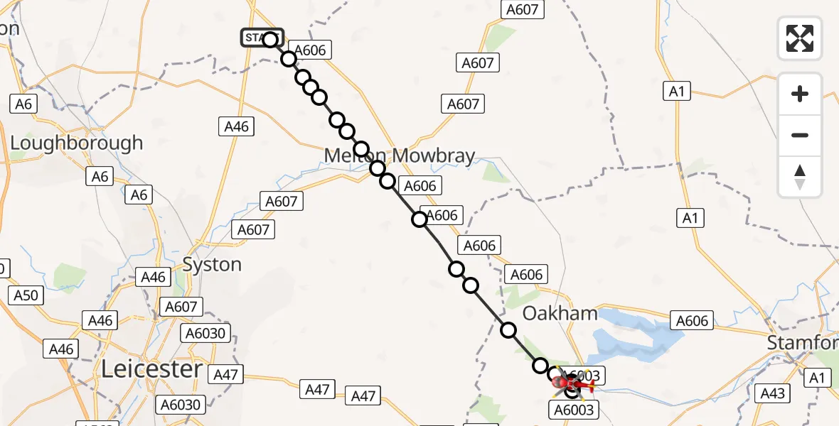
On Wednesday, 18 March 2026 at 15:15, a Air Ambulance Helicopter departed from Rushcliffe to Manton. It was the Air Ambulance Helicopter with registration number G-DRLA. The flight lasted 9 minutes. During that period, the aircraft travelled 20 miles at an average speed of 139 miles per hour at a maximum altitude of 975 feet.
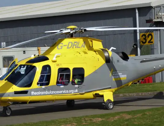
Helicopter: G-DRLA
The helicopter G-DRLA is used as an ambulance helicopter. The helicopter is equipped with a stretcher for transporting patients. The helicopter is often used to transport to hospitals.
Photo: Alec Wilson
21 miles
975 feet
139 mph
9 minutes
15:15
15:24

Route
Uppingham Road, Manton15:24
Manton, Manton15:23
Preston, Preston15:23
Manton, Manton15:23
Martinsthorpe, Martinsthorpe15:22
Brooke, Brooke15:22
Braunston-in-Rutland, Braunston-in-Rutland15:21
Cold Overton, Melton15:20
Pickwell, Melton15:20
Little Dalby, Melton15:19
Melton Mowbray, Melton15:18
Sysonby, Melton15:18
Asfordby Hill, Melton15:17
Melton Mowbray, Melton15:17
Wartnaby, Melton15:17
Saxelbye, Melton15:16
Grimston, Melton15:16
Queensway Old Dalby, Melton15:16
Upper Broughton, Rushcliffe15:16
Hickling, Rushcliffe15:15
Folly Hall Lane, East Midlands15:15
Live flights
Police Helicopter on its way from RAF Benson12 Jul 22:54
Police Helicopter on its way from Dundrod12 Jul 22:50
Today
Police Helicopter to East Ardsley, Stoney Lane12 Jul 23:51
Police Helicopter to Birmingham Airport12 Jul 23:46
Air Ambulance Helicopter to Glasgow Airport12 Jul 22:48
Police Helicopter to Walton Wood Airfield12 Jul 22:44
Flights Manton
Flights Rushcliffe
Air Ambulance Helicopter to Rushcliffe, A461 Jul 18:42
Air Ambulance Helicopter to Ashwell, Oakham30 Jun 12:44
Air Ambulance Helicopter to Rushcliffe, A4629 Jun 11:54
Air Ambulance Helicopter to East Carlton, A42727 Jun 11:00
Helicopter flights on your website?
You can easily display helicopter flights on your own website. Use the embed code.
