Air Ambulance Helicopter to Nottingham Heliport
Wednesday, 18 March 2026 | 10:51 | From Leabrooks
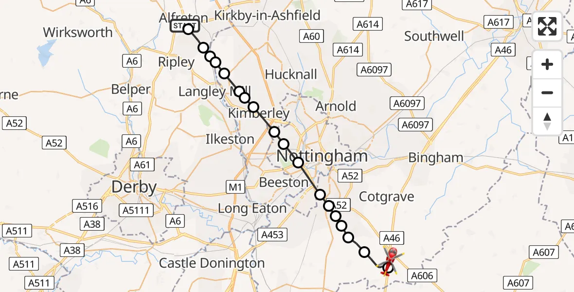
On Wednesday, 18 March 2026 at 10:51, a Air Ambulance Helicopter departed from Leabrooks to Nottingham Heliport. It was the Air Ambulance Helicopter with registration number G-DRLA. The flight lasted 10 minutes. During that period, the aircraft travelled 25 miles at an average speed of 151 miles per hour at a maximum altitude of 1200 feet.
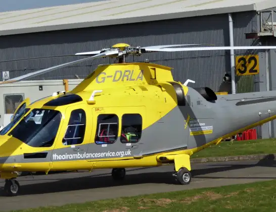
Helicopter: G-DRLA
The helicopter G-DRLA is used as an ambulance helicopter. The helicopter is equipped with a stretcher for transporting patients. The helicopter is often used to transport to hospitals.
Photo: Alec Wilson
25 miles
1200 feet
151 mph
10 minutes
10:51
11:00

Route
Nottingham Heliport, 11:00
Nottingham Heliport11:00
Widmerpool, Rushcliffe10:59
Keyworth, Rushcliffe10:58
Bradmore, Rushcliffe10:58
Ruddington, Rushcliffe10:57
Ruddington, West Bridgford10:57
West Bridgford, Rushcliffe10:57
City of Nottingham, City of Nottingham10:56
Wollaton, City of Nottingham10:55
Bulwell, City of Nottingham10:55
Watnall, Kimberley10:54
Greasley, Broxtowe10:53
Newthorpe, Eastwood10:53
Brinsley, Broxtowe10:52
Selston CP, Ashfield10:52
Codnor Park, Amber Valley10:52
Ironville, Amber Valley10:52
Somercotes CP, Amber Valley10:51
A38, Alfreton CP10:51
Live flights
Today
Flights Leabrooks
Air Ambulance Helicopter to Nottingham Heliport18 Mar 10:51
Helicopter flights on your website?
You can easily display helicopter flights on your own website. Use the embed code.
