Coastguard Helicopter to Boath, Inverness Airport
Tuesday, 17 March 2026 | 20:32 | From Inverness Airport
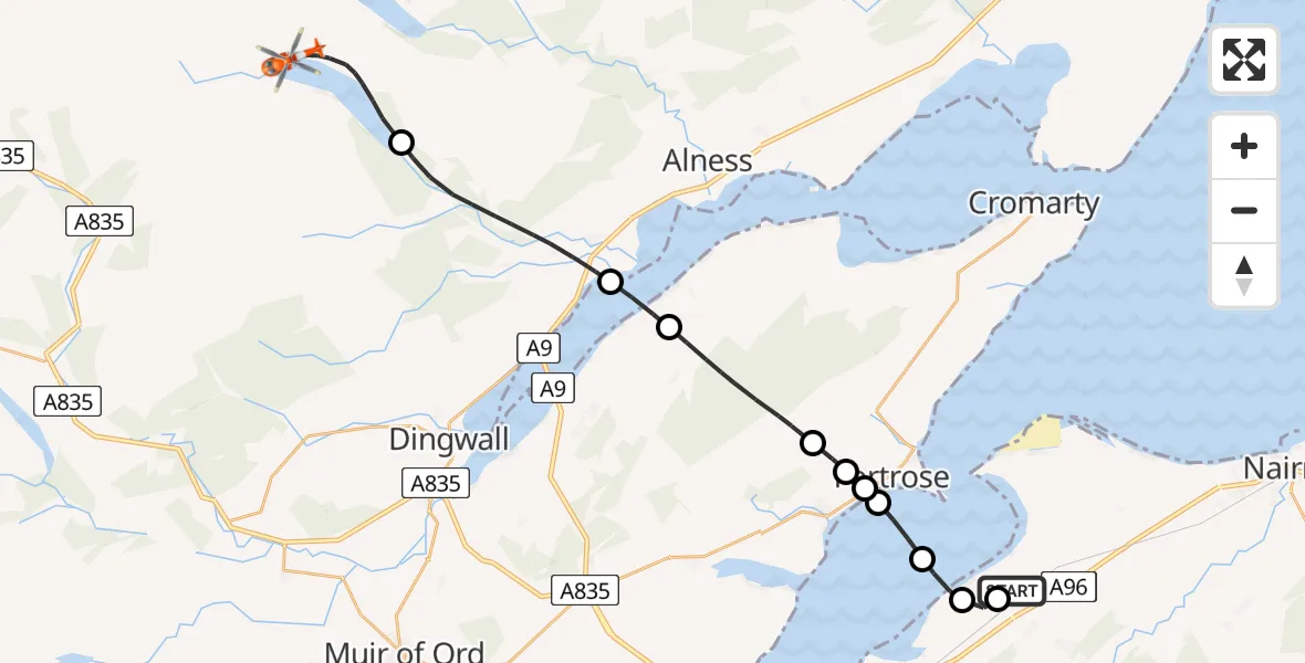
On Tuesday, 17 March 2026 at 20:32, a Coastguard Helicopter departed from Inverness Airport to Boath. It was the Coastguard Helicopter with registration number G-MCGX. The flight lasted 14 minutes. During that period, the aircraft travelled 23 miles at an average speed of 103 miles per hour at a maximum altitude of 2300 feet.
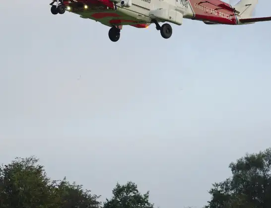
Helicopter: G-MCGX
The helicopter G-MCGX is used by the British Coastguard. The helicopter is deployed in search and rescue operations at sea, rescue operations involving ships or drilling platforms, patrols to prevent smuggling or piracy, environmental monitoring and disaster relief support.
Photo: Nick (UK)
24 miles
2300 feet
103 mph
14 minutes
20:32
20:45

Route
20:45
Boath, Boath20:43
Evanton, Evanton20:39
Resolis, Resolis20:38
Killen, Killen20:36
Fortrose, Fortrose20:36
Avoch, Avoch20:35
Fortrose, Fortrose20:35
Rosemarkie, Rosemarkie20:34
Inverness, Inverness20:33
Tornagrain, Tornagrain20:33
Inverness Airport, Inverness20:32
Live flights
Police Helicopter on its way from Ewelme13 Jul 22:24
Today
Police Helicopter to Bournemouth Airport13 Jul 23:55
Air Ambulance Helicopter to Cardiff Heliport13 Jul 23:38
Police Helicopter to Birmingham Airport13 Jul 23:21
Police Helicopter to Irlam, Twelve Yards Road13 Jul 23:00
Flights Boath
Coastguard Helicopter to Inverness Airport17 Mar 21:23
Air Ambulance Aircraft to Boath15 Jan 12:56
Helicopter flights on your website?
You can easily display helicopter flights on your own website. Use the embed code.
