Air Ambulance Helicopter to Hamsterley
Tuesday, 17 March 2026 | 15:59 | From Longnewton
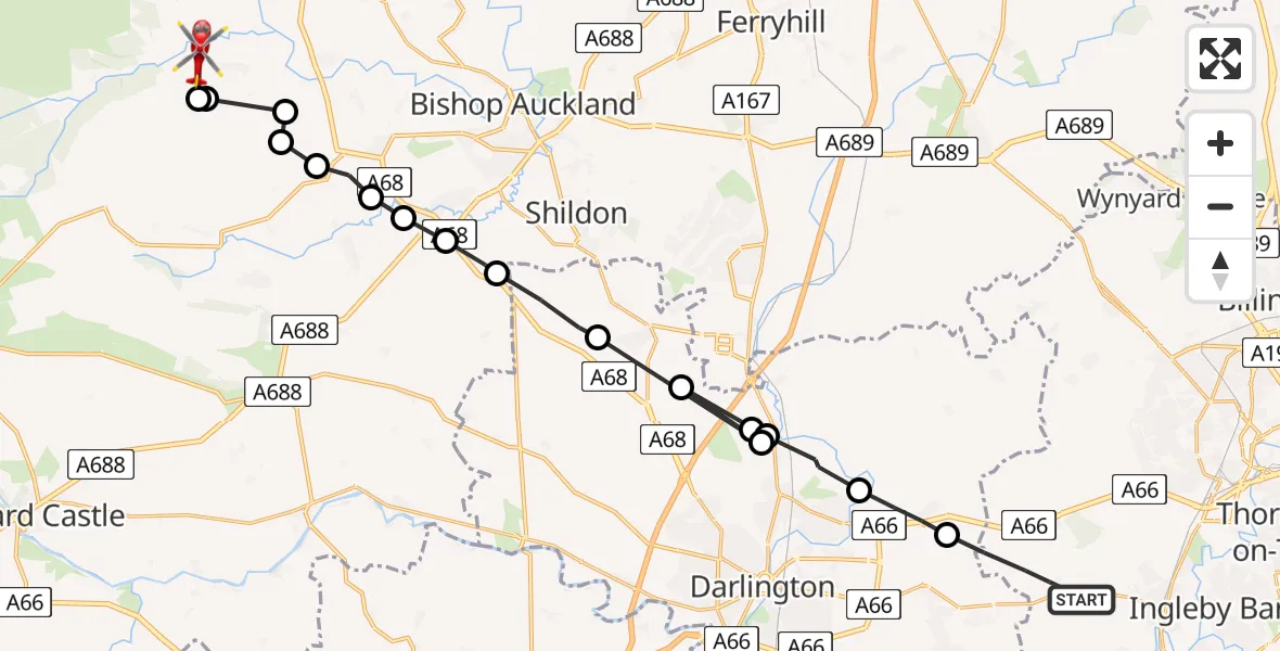
On Tuesday, 17 March 2026 at 15:59, a Air Ambulance Helicopter departed from Longnewton to Hamsterley. It was the Air Ambulance Helicopter with registration number G-NHAE. The flight lasted 9 minutes. During that period, the aircraft travelled 26 miles at an average speed of 173 miles per hour at a maximum altitude of 1675 feet.
Helicopter: G-NHAE
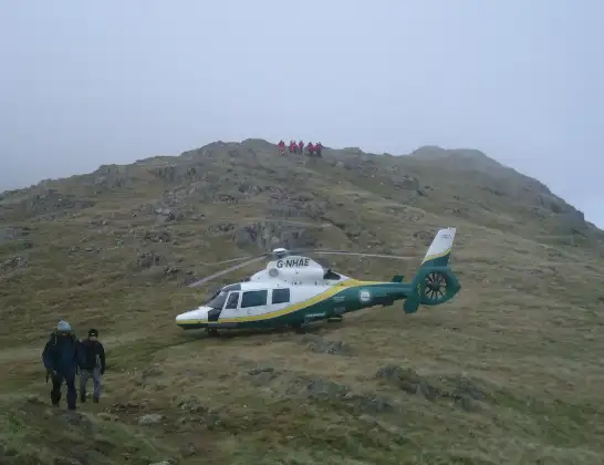
The helicopter G-NHAE is used as a air ambulance helicopter. The main purpose of this aircraft is to transport a Mobile Medical Team to an incident as quickly as possible, enabling the trauma doctor to provide immediate first aid on site. The aircraft is flying this flight as Air Ambulance Helicopter.
Photo: Michael Earnshaw
27 miles
1675 feet
173 mph
10 minutes
15:59
16:08

Route
Hamsterley, North East16:08
Hamsterley, North East16:08
Bishop Auckland, North East16:07
Hamsterley, North East16:07
Evenwood and Barony, North East16:07
Ramshaw, North East16:06
Toft Hill, North East16:06
Evenwood, North East16:06
West Auckland, North East16:05
Heighington, North East16:05
Heighington, Tees Valley16:04
Whessoe, Tees Valley16:03
Coatham Mundeville, Tees Valley16:03
Whessoe, Tees Valley16:03
Coatham Mundeville, Tees Valley16:02
Barmpton, Tees Valley16:02
Sadberge, Tees Valley16:01
A67, Tees Valley15:59
Live flights
Today
Flights Hamsterley
Air Ambulance Helicopter to Hamsterley17 Mar 15:59
Flights Longnewton
Police Helicopter to Longnewton7 Jun 15:05
Helicopter flights on your website?
You can easily display helicopter flights on your own website. Use the embed code.
