Air Ambulance Helicopter to Heanor, Stainsby Avenue
Tuesday, 17 March 2026 | 12:20 | From Widmerpool
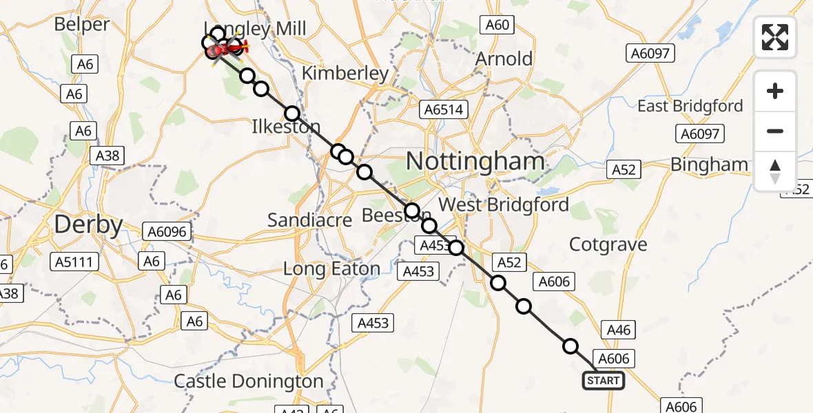
On Tuesday, 17 March 2026 at 12:20, a Air Ambulance Helicopter departed from Widmerpool to Heanor. It was the Air Ambulance Helicopter with registration number G-DRLA. The flight lasted 10 minutes. During that period, the aircraft travelled 23 miles at an average speed of 139 miles per hour at a maximum altitude of 1125 feet.
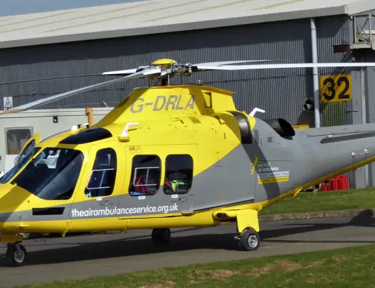
Helicopter: G-DRLA
The helicopter G-DRLA is used as an ambulance helicopter. The helicopter is equipped with a stretcher for transporting patients. The helicopter is often used to transport to hospitals.
Photo: Alec Wilson
24 miles
1125 feet
139 mph
10 minutes
12:20
12:30

Route
Stainsby Avenue, Amber Valley12:30
Heanor, Amber Valley12:29
Marlpool, Amber Valley12:29
Heanor, Amber Valley12:29
Smalley CP, Heanor12:28
Heanor, Amber Valley12:27
Smalley CP, Heanor12:27
Ilkeston, Erewash12:26
Shipley, Amber Valley12:26
Ilkeston, Erewash12:25
Trowell, Broxtowe12:25
Trowell, City of Nottingham12:25
Bramcote, City of Nottingham12:24
Beeston, City of Nottingham12:23
Beeston, Broxtowe12:23
City of Nottingham, East Midlands12:23
Ruddington, Rushcliffe12:22
Bradmore, Rushcliffe12:22
Keyworth, Rushcliffe12:21
Penn Lane, Rushcliffe12:20
Live flights
Today
Flights Heanor
Air Ambulance Helicopter to Heanor, Church Lane24 Jun 07:22
Air Ambulance Helicopter to Heanor, Park Street12 Jun 17:06
Air Ambulance Helicopter to Nottingham Heliport15 Mar 08:52
Flights Widmerpool
Air Ambulance Helicopter to Carsington Water4 Jul 11:57
Air Ambulance Helicopter to Mansfield1 Jul 17:09
Air Ambulance Helicopter to Brierley Green28 Jun 16:16
Helicopter flights on your website?
You can easily display helicopter flights on your own website. Use the embed code.
