Police Helicopter to Calderbraes, Glenacre Crescent
Monday, 16 March 2026 | 22:27 | From New Stevenston
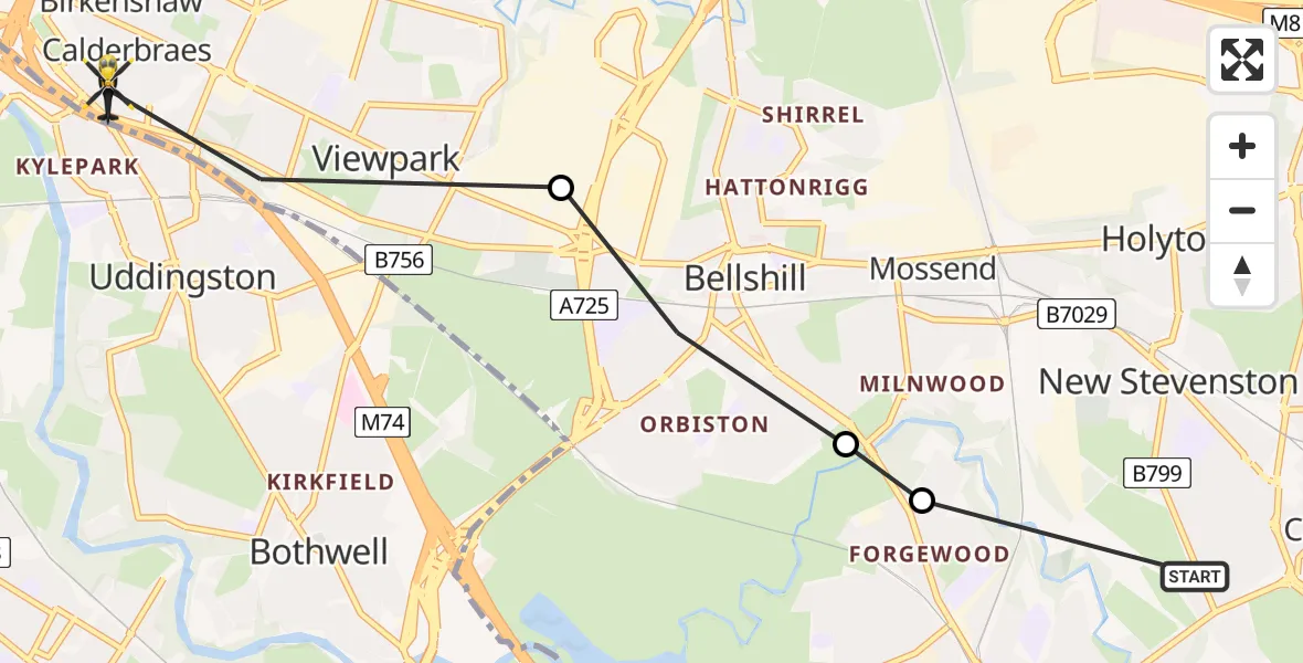
On Monday, 16 March 2026 at 22:27, a Police Helicopter departed from New Stevenston to Calderbraes. It was the Police Helicopter with registration number G-PSHU. The flight lasted 3 minutes. During that period, the aircraft travelled 5 miles at an average speed of 106 miles per hour at a maximum altitude of 1775 feet.
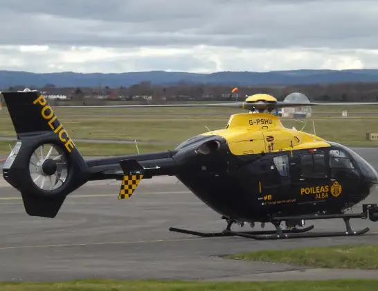
Helicopter: G-PSHU
The helicopter G-PSHU is used by the British police. The helicopter is deployed in pursuits, missing persons cases and other incidents where a helicopter provides added value.
Photo: James from Cheltenham, Gloucestershire
6 miles
1775 feet
106 mph
3 minutes
22:27
22:29

Route
Glenacre Crescent, Calderbraes22:29
Viewpark, Viewpark22:28
Bellshill, Bellshill22:27
Motherwell, Motherwell22:27
Jerviston Road, New Stevenston22:27
Live flights
Today
Flights Calderbraes
Police Helicopter to Calderbraes17 Apr 14:41
Police Helicopter to Motherwell, Watling Street16 Apr 17:30
Police Helicopter to Calderbraes, Ardgowan Drive11 Mar 22:29
Police Helicopter to Nerston Village, Kingsway24 Jan 21:34
Helicopter flights on your website?
You can easily display helicopter flights on your own website. Use the embed code.
