Coastguard Helicopter to Altnaharra, Inverness Airport
Monday, 16 March 2026 | 21:42 | From Inverness Airport
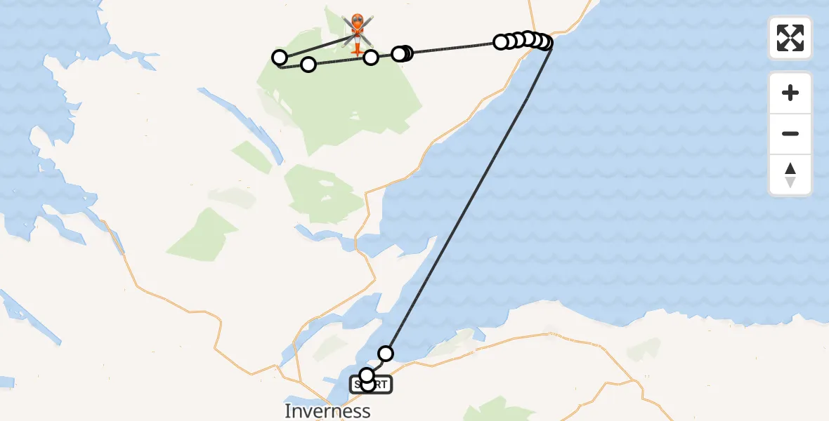
On Monday, 16 March 2026 at 21:42, a Coastguard Helicopter departed from Inverness Airport to Altnaharra. It was the Coastguard Helicopter with registration number G-MCGX. The flight lasted 50 minutes. During that period, the aircraft travelled 115 miles at an average speed of 140 miles per hour at a maximum altitude of 5050 feet.
Helicopter: G-MCGX
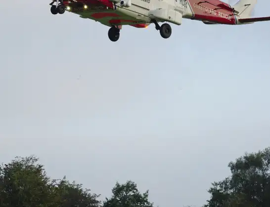
The helicopter G-MCGX is used by the British Coastguard. The helicopter is deployed in search and rescue operations at sea, rescue operations involving ships or drilling platforms, patrols to prevent smuggling or piracy, environmental monitoring and disaster relief support.
Photo: Nick (UK)
116 miles
5050 feet
140 mph
50 minutes
21:42
22:31

Route
22:31
Altnaharra, Altnaharra22:28
Loch Choire22:25
Badanloch Lodge, Badanloch Lodge22:19
Kinbrace, Kinbrace22:16
Achentoul, Achentoul22:16
Kinbrace, Kinbrace22:16
Dunbeath, Dunbeath22:07
Lodesbest, Lodesbest22:06
Houstry, Houstry22:05
Smerral, Smerral22:04
Latheronwheel, Latheronwheel22:04
Latheron, Latheron22:03
Forse, Forse22:03
North Sea21:46
Ardersier, Ardersier21:44
Inverness, Inverness21:43
Inverness Airport, Inverness21:42
Today
Flights Altnaharra
Air Ambulance Helicopter to Altnaharra, B87324 Jun 16:58
Helicopter flights on your website?
You can easily display helicopter flights on your own website. Use the embed code.
