Air Ambulance Helicopter to Beeston, Westward Avenue
Sunday, 15 March 2026 | 16:51 | From Syston
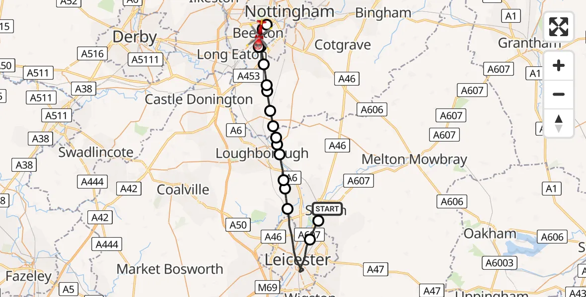
On Sunday, 15 March 2026 at 16:51, a Air Ambulance Helicopter departed from Syston to Beeston. It was the Air Ambulance Helicopter with registration number G-DRLA. The flight lasted 19 minutes. During that period, the aircraft travelled 31 miles at an average speed of 96 miles per hour at a maximum altitude of 1375 feet.
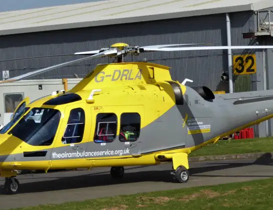
Helicopter: G-DRLA
The helicopter G-DRLA is used as an ambulance helicopter. The helicopter is equipped with a stretcher for transporting patients. The helicopter is often used to transport to hospitals.
Photo: Alec Wilson
31 miles
1375 feet
96 mph
20 minutes
16:51
17:10

Route
Westward Avenue, City of Nottingham17:10
City of Nottingham, City of Nottingham17:09
Beeston, Broxtowe17:09
Broxtowe, East Midlands17:09
City of Nottingham, City of Nottingham17:08
Barton-in-Fabis, Rushcliffe17:08
Gotham, Rushcliffe17:07
West Leake, Rushcliffe17:07
East Leake, Rushcliffe17:06
Stanford on Soar, Rushcliffe17:06
Charnwood, Charnwood17:05
Cotes, Charnwood17:05
Burton on the Wolds, Charnwood17:05
Quorn, Charnwood17:04
Mountsorrel, Charnwood17:04
Rothley, Charnwood17:03
Leicester, Leicester16:52
Thurmaston, Charnwood16:51
Shirley Drive, Charnwood16:51
Live flights
Police Helicopter on its way from Coopersale6 Jul 22:57
Police Helicopter on its way from Glasgow6 Jul 22:39
Today
Air Ambulance Aircraft to Greenigoe6 Jul 21:45
Coastguard Helicopter to Humberside Airport6 Jul 21:43
Air Ambulance Helicopter to RAF Northolt6 Jul 21:24
Police Helicopter to Birmingham Airport6 Jul 21:17
Police Helicopter to Hawarden Airport6 Jul 20:38
Flights Beeston
Air Ambulance Helicopter to Coventry Airport26 Jun 21:01
Air Ambulance Helicopter to Beeston, Autumn Way24 Jun 07:45
Air Ambulance Helicopter to Beeston, Padge Road23 Jun 21:32
Air Ambulance Helicopter to Beeston, Padge Road21 Jun 16:59
Flights Syston
Air Ambulance Helicopter to Nottingham Heliport25 May 21:37
Helicopter flights on your website?
You can easily display helicopter flights on your own website. Use the embed code.
