Air Ambulance Helicopter to Egglescliffe, Longnewton Lane
Saturday, 14 March 2026 | 12:53 | From Billingham
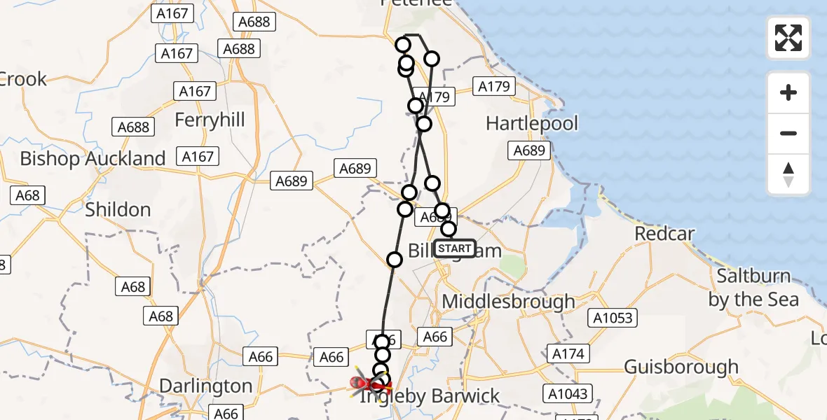
On Saturday, 14 March 2026 at 12:53, a Air Ambulance Helicopter departed from Billingham to Egglescliffe. It was the Air Ambulance Helicopter with registration number G-NHAE. The flight lasted 11 minutes. During that period, the aircraft travelled 25 miles at an average speed of 139 miles per hour at a maximum altitude of 2200 feet.
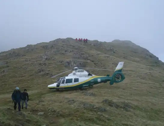
Helicopter: G-NHAE
The helicopter G-NHAE is used as a air ambulance helicopter. The main purpose of this aircraft is to transport a Mobile Medical Team to an incident as quickly as possible, enabling the trauma doctor to provide immediate first aid on site. The aircraft is flying this flight as Air Ambulance Helicopter.
Photo: Michael Earnshaw
26 miles
2200 feet
139 mph
12 minutes
12:53
13:04

Route
Longnewton Lane, Tees Valley13:04
Egglescliffe, Tees Valley13:04
Eaglescliffe, Tees Valley13:03
Egglescliffe, Tees Valley13:03
Preston-on-Tees, Tees Valley13:03
Elton, Tees Valley13:03
Stockton-on-Tees, Tees Valley13:01
Wynyard, Tees Valley13:01
Wynyard, Tees Valley13:00
Elwick, Tees Valley12:59
Sheraton with Hulam, North East12:58
Castle Eden, North East12:57
Hutton Henry, North East12:57
Station Town, North East12:57
Sheraton with Hulam, North East12:56
Elwick, Tees Valley12:55
Wynyard, Tees Valley12:54
Wolviston, Tees Valley12:54
The Causeway, Tees Valley12:53
Live flights
Today
Flights Egglescliffe
Air Ambulance Helicopter to Egglescliffe, A6713 Jul 15:39
Air Ambulance Helicopter to Egglescliffe, A6713 Jul 13:57
Air Ambulance Helicopter to Egglescliffe10 Jul 15:36
Flights Billingham
Helicopter flights on your website?
You can easily display helicopter flights on your own website. Use the embed code.
