Air Ambulance Helicopter to Cwmgwrach, B4242
Friday, 13 March 2026 | 22:26 | From Swansea Airport
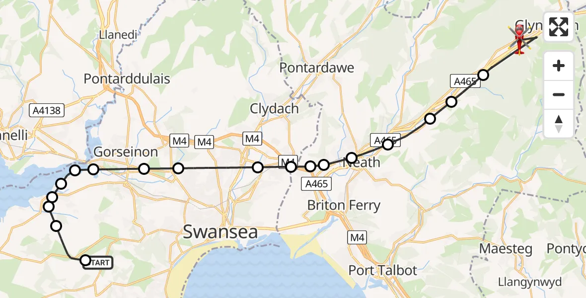
On Friday, 13 March 2026 at 22:26, a Air Ambulance Helicopter departed from Swansea Airport to Cwmgwrach. It was the Air Ambulance Helicopter with registration number G-WYDN. The flight lasted 18 minutes. During that period, the aircraft travelled 28 miles at an average speed of 97 miles per hour at a maximum altitude of 2400 feet.

Helicopter: G-WYDN
The helicopter G-WYDN is used as a air ambulance helicopter. The main purpose of this aircraft is to transport a Mobile Medical Team to an incident as quickly as possible, enabling the trauma doctor to provide immediate first aid on site. The aircraft is flying this flight as Air Ambulance Helicopter.
Photo: Tony Melony
29 miles
2400 feet
97 mph
18 minutes
22:26
22:43

Route
B4242, Glynneath22:43
Cwmgwrach, Cwmgwrach22:40
Abergarwed, Abergarwed22:39
Ynysarwed, Ynysarwed22:39
Tonna, Tonna22:38
Cadoxton-juxta-Neath, Cadoxton-juxta-Neath22:37
Neath, Neath22:36
Skewen, Skewen22:36
Skewen, Skewen22:36
Tregof, Tregof22:35
Swansea, Swansea22:34
Gorseinon, Gorseinon22:33
Upper Loughor, Gorseinon22:32
Gowerton, Gowerton22:32
Llanrhidian Higher, Llanrhidian Higher22:32
Penclawdd, Penclawdd22:31
Crofty, Crofty22:31
Llanmorlais, Llanmorlais22:30
Ilston, Ilston22:28
Swansea Airport, Swansea22:26
Live flights
Today
Flights Cwmgwrach
Air Ambulance Helicopter to Tonna, A46513 Mar 22:45
Air Ambulance Helicopter to Cwmgwrach, B424213 Mar 22:26
Helicopter flights on your website?
You can easily display helicopter flights on your own website. Use the embed code.
