Air Ambulance Helicopter to Wrexham, Sontley Road
Friday, 13 March 2026 | 18:04 | From Pantasaph

On Friday, 13 March 2026 at 18:04, a Air Ambulance Helicopter departed from Pantasaph to Wrexham. It was the Air Ambulance Helicopter with registration number G-WENU. The flight lasted 11 minutes. During that period, the aircraft travelled 23 miles at an average speed of 126 miles per hour at a maximum altitude of 1975 feet.
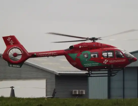
Helicopter: G-WENU
The helicopter G-WENU is used as a air ambulance helicopter. The main purpose of this aircraft is to transport a Mobile Medical Team to an incident as quickly as possible, enabling the trauma doctor to provide immediate first aid on site. The aircraft is flying this flight as Air Ambulance Helicopter.
Photo: James from Cheltenham, Gloucestershire
24 miles
1975 feet
126 mph
12 minutes
18:04
18:15

Route
Sontley Road, Wrexham18:15
Wrexham, Wrexham18:12
Stansty, Stansty18:11
Summerhill, Summerhill18:11
Sydallt, Sydallt18:10
Cefn-y-bedd, Cefn-y-bedd18:10
Caergwrle, Caergwrle18:09
Pont-Y-Bodkin, Pont-Y-Bodkin18:09
Leeswood, Leeswood18:09
Buckley, Buckley18:08
Mynydd Isa, Mynydd Isa18:08
New Brighton, New Brighton18:08
Sychdyn, Sychdyn18:07
Northop, Northop18:07
Rhosesmor, Rhosesmor18:06
Halkyn, Halkyn18:05
Pentre Halkyn, Pentre Halkyn18:05
Brynford, Brynford18:04
Calcoed, Calcoed18:04
Post Office Lane, Pantasaph18:04
Live flights
Today
Flights Wrexham
Air Ambulance Helicopter to Welshpool Airport13 Mar 18:25
Air Ambulance Helicopter to Welshpool Airport11 Feb 15:08
Air Ambulance Helicopter to Wrexham, Ruthin Road11 Feb 14:03
Police Helicopter to Cockshutt, A5285 Feb 13:05
Air Ambulance Helicopter to Welshpool Airport31 Jan 17:05
Air Ambulance Helicopter to Wrexham, Ruthin Road31 Jan 16:23
Flights Pantasaph
Helicopter flights on your website?
You can easily display helicopter flights on your own website. Use the embed code.
