Police Helicopter to South Nutfield, Crab Hill Lane
Friday, 13 March 2026 | 14:00 | From Redhill
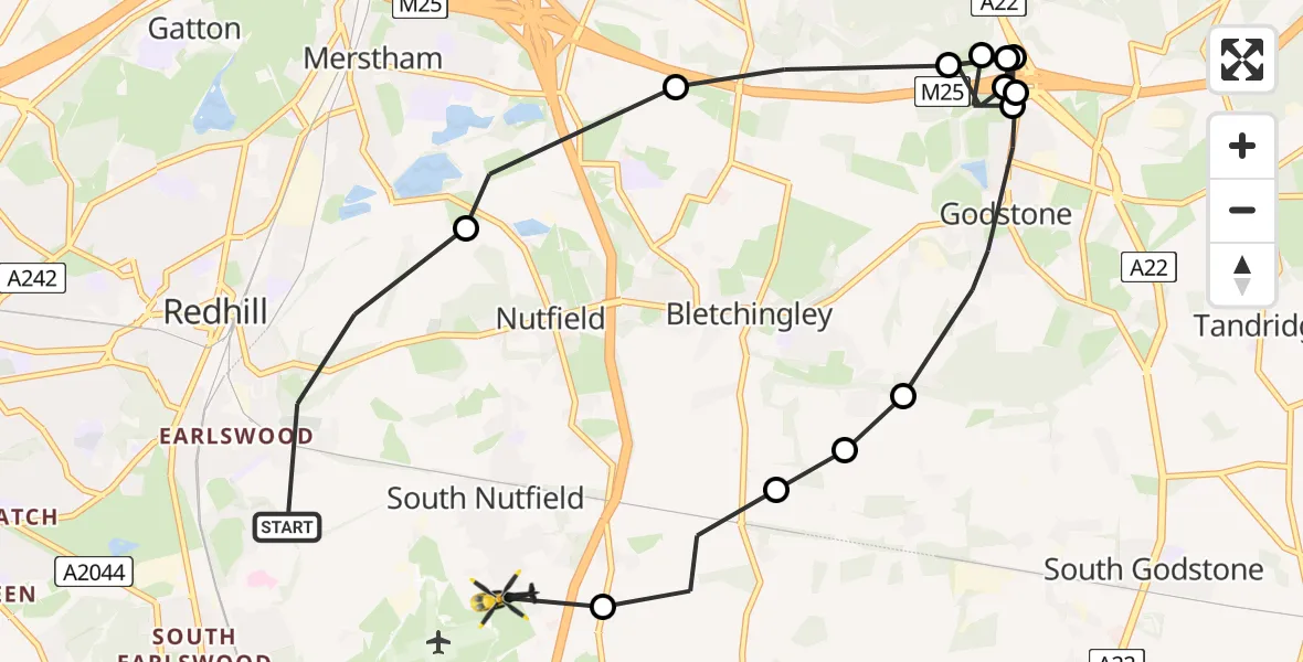
On Friday, 13 March 2026 at 14:00, a Police Helicopter departed from Redhill to South Nutfield. It was the Police Helicopter with registration number G-POLH. The flight lasted 7 minutes. During that period, the aircraft travelled 12 miles at an average speed of 97 miles per hour at a maximum altitude of 1800 feet.
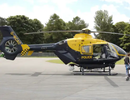
Helicopter: G-POLH
The helicopter G-POLH is used by the British police. The helicopter is deployed in pursuits, missing persons cases and other incidents where a helicopter provides added value.
Photo: Arpingstone
12 miles
1800 feet
97 mph
8 minutes
14:00
14:07

Route
Crab Hill Lane, South Nutfield14:07
South Nutfield, South Nutfield14:07
Tandridge, Tandridge14:06
Bletchingley, Bletchingley14:06
Tandridge, Tandridge14:05
Godstone, Godstone14:04
Tandridge, Caterham14:04
Godstone, Godstone14:03
Tandridge, Caterham14:03
Godstone, Godstone14:02
Tandridge, Caterham14:02
Godstone, Godstone14:02
Tandridge, Caterham14:01
Nutfield, Nutfield14:00
Reed Drive, Reigate and Banstead14:00
Live flights
Today
Flights Redhill
Police Helicopter to Tandridge, Moats Lane29 May 15:09
Police Helicopter to North Weald Airfield20 May 11:58
Police Helicopter to Betchworth, FP 44819 Apr 12:44
Police Helicopter to Salfords, Moats Lane31 Mar 14:37
Police Helicopter to Redhill Aerodrome30 Mar 13:28
Police Helicopter to Redhill Aerodrome28 Mar 18:17
Police Helicopter to Redhill, Canadian Road16 Mar 15:59
Helicopter flights on your website?
You can easily display helicopter flights on your own website. Use the embed code.
