Air Ambulance Helicopter to Llandynan, Horseshoe Pass
Friday, 13 March 2026 | 11:01 | From Welshpool Airport
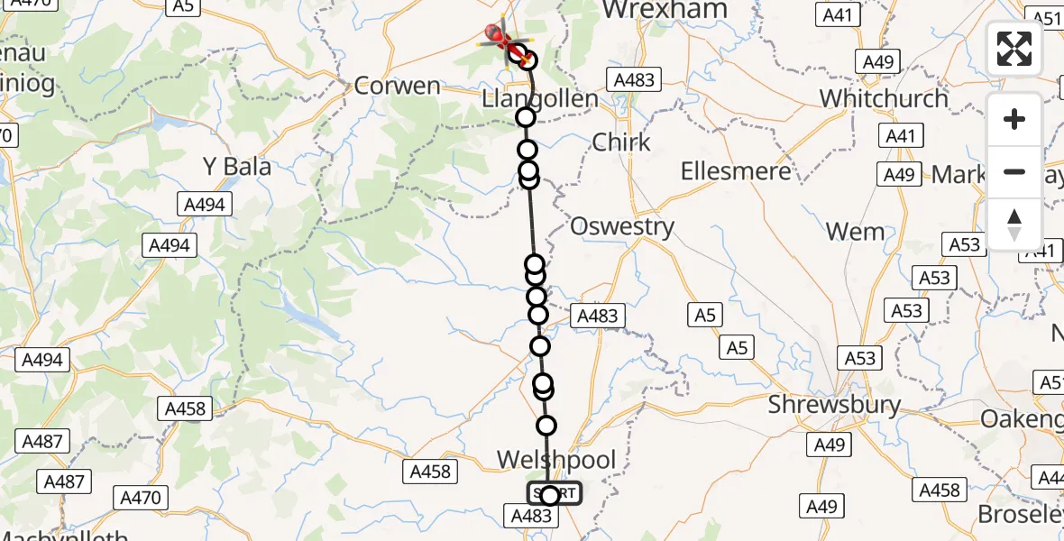
On Friday, 13 March 2026 at 11:01, a Air Ambulance Helicopter departed from Welshpool Airport to Llandynan. It was the Air Ambulance Helicopter with registration number G-WENU. The flight lasted 17 minutes. During that period, the aircraft travelled 28 miles at an average speed of 99 miles per hour at a maximum altitude of 2575 feet.
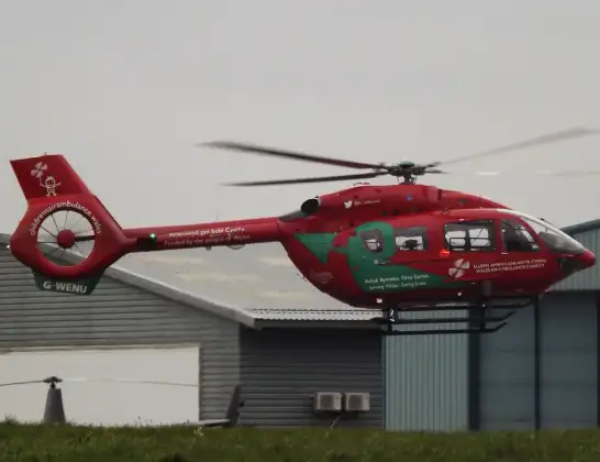
Helicopter: G-WENU
The helicopter G-WENU is used as a air ambulance helicopter. The main purpose of this aircraft is to transport a Mobile Medical Team to an incident as quickly as possible, enabling the trauma doctor to provide immediate first aid on site. The aircraft is flying this flight as Air Ambulance Helicopter.
Photo: James from Cheltenham, Gloucestershire
28 miles
2575 feet
99 mph
17 minutes
11:01
11:18

Route
Horseshoe Pass, Llandynan11:18
Llandynan, Llandynan11:16
Llantysilio, Llantysilio11:15
Llangollen, Llangollen11:13
Glyn Ceiriog, Glyn Ceiriog11:12
Pandy, Pandy11:12
Ceiriog Ucha, Ceiriog Ucha11:11
Llansilin, Llansilin11:09
Llanyblodwel, Llanyblodwel11:09
Pen-y-bont Llannerch Emrys, Pen-y-bont Llannerch Emrys11:08
Llanfechain, Llanfechain11:08
Llansantffraid-ym-Mechain, Llansantffraid-ym-Mechain11:07
Sarnau, Sarnau11:06
Guilsfield, Guilsfield11:06
Groes-lwyd, Groes-lwyd11:05
Welshpool, Welshpool11:03
Welshpool Airport, Welshpool, Powys11:02
Welshpool Airport, Welshpool, Powys11:01
Live flights
Police Helicopter on its way from RAF Benson12 Jul 22:54
Police Helicopter on its way from Dundrod12 Jul 22:50
Today
Air Ambulance Helicopter to Glasgow Airport12 Jul 22:48
Police Helicopter to Walton Wood Airfield12 Jul 22:44
Air Ambulance Helicopter to Norwich Airport12 Jul 22:27
Air Ambulance Helicopter to Northrepps Aerodrome12 Jul 22:23
Flights Llandynan
Air Ambulance Helicopter to Llangollen, A54213 Mar 13:13
Helicopter flights on your website?
You can easily display helicopter flights on your own website. Use the embed code.
