Air Ambulance Helicopter to RAF Topcliffe
Wednesday, 11 March 2026 | 11:17 | From Ripon
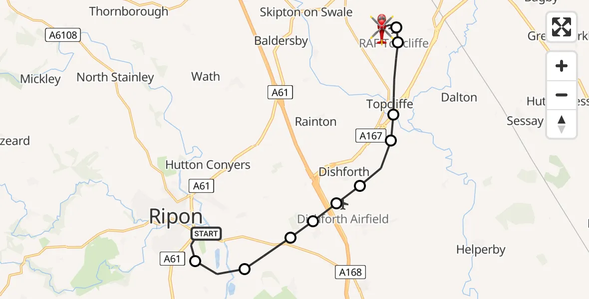
On Wednesday, 11 March 2026 at 11:17, a Air Ambulance Helicopter departed from Ripon to RAF Topcliffe. It was the Air Ambulance Helicopter with registration number G-YAAA. The flight lasted 9 minutes. During that period, the aircraft travelled 11 miles at an average speed of 72 miles per hour at a maximum altitude of 1400 feet.
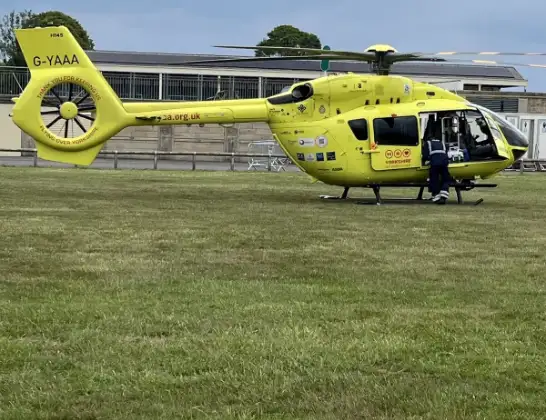
Helicopter: G-YAAA
The helicopter G-YAAA is used as a air ambulance helicopter. The main purpose of this aircraft is to transport a Mobile Medical Team to an incident as quickly as possible, enabling the trauma doctor to provide immediate first aid on site. The aircraft is flying this flight as Air Ambulance Helicopter.
Photo: Jennifer Petrie
11 miles
1400 feet
72 mph
10 minutes
11:17
11:26

Route
RAF Topcliffe, Thirsk, North Yorkshire11:26
RAF Topcliffe, Thirsk, North Yorkshire11:26
RAF Topcliffe, Thirsk, North Yorkshire11:24
RAF Topcliffe, Thirsk, North Yorkshire11:23
Topcliffe, Thirsk11:22
Topcliffe, York and North Yorkshire11:21
Asenby, York and North Yorkshire11:21
Dishforth, York and North Yorkshire11:20
Dishforth Airfield / RAF Dishforth, Thirsk, North Yorkshire11:20
Hutton Conyers, York and North Yorkshire11:20
Marton-le-Moor, York and North Yorkshire11:20
Givendale, York and North Yorkshire11:19
Littlethorpe, York and North Yorkshire11:18
Charter Road, York and North Yorkshire11:17
Live flights
Police Helicopter on its way from RAF Benson12 Jul 22:54
Police Helicopter on its way from Dundrod12 Jul 22:50
Today
Air Ambulance Helicopter to Glasgow Airport12 Jul 22:48
Police Helicopter to Walton Wood Airfield12 Jul 22:44
Air Ambulance Helicopter to Norwich Airport12 Jul 22:27
Air Ambulance Helicopter to Northrepps Aerodrome12 Jul 22:23
Flights Ripon
Air Ambulance Helicopter to RAF Topcliffe11 May 14:19
Air Ambulance Helicopter to RAF Topcliffe11 Mar 11:17
Helicopter flights on your website?
You can easily display helicopter flights on your own website. Use the embed code.
